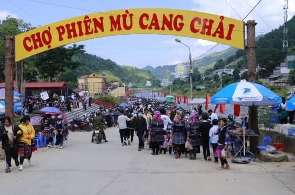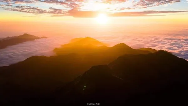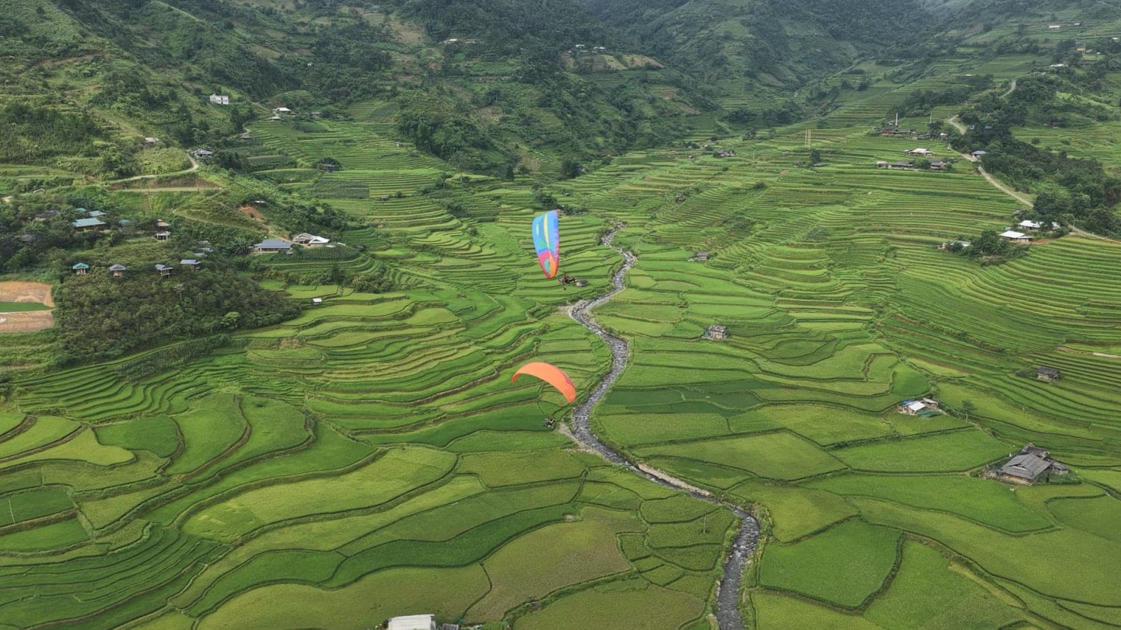
Why is Mù Cang Chải busy in every season? The answer lies along barely 50 km of National Road 32 (QL32): from the Tú Lệ valley the road climbs over Khau Phạ Pass, then drops down to La Pán Tẩn and the centre of Mù Cang Chải. Along the way you pass hot springs, Thái and Hmong villages, a paragliding site, bamboo forests and rice-terrace hills that are listed as a Special National Monument.
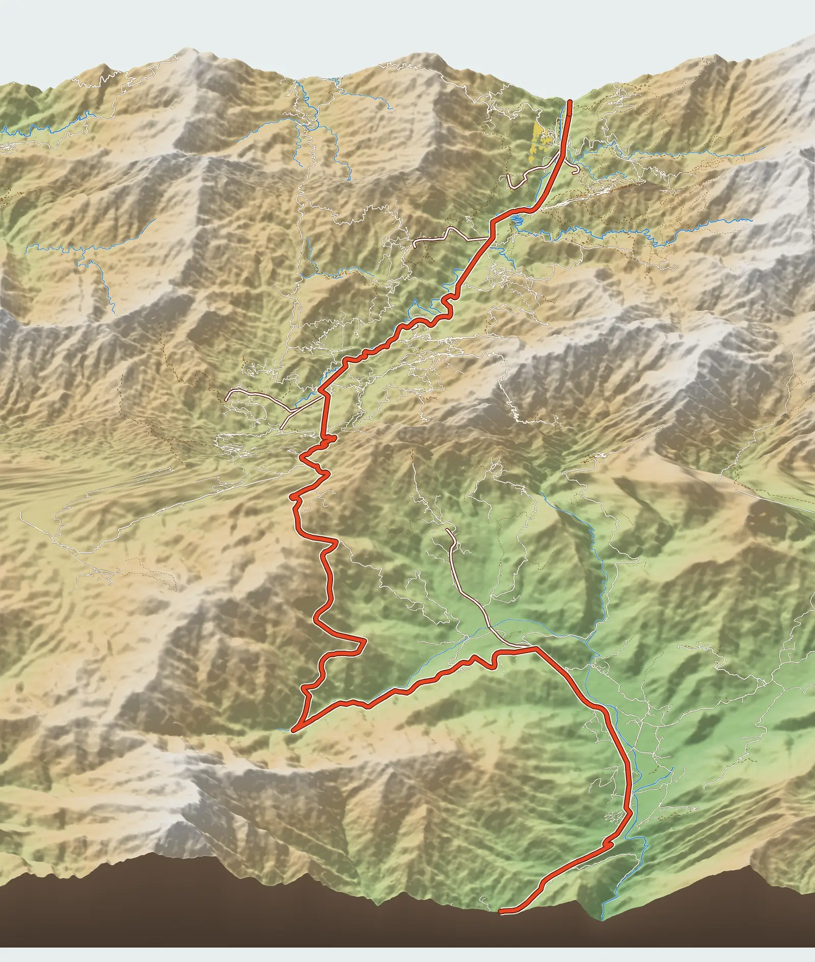
This is a 3D travel map of Mù Cang Chải and Tú Lệ that gathers all 18 check-in stops along the route, each with its kilometre mark, elevation, best season and a dedicated article. Tap a stop on the map to fly in and see photos; drag, rotate and zoom as you like. Distances follow the actual road from the gate of Le Champ in Tú Lệ (Km 0).
- Where: the mountains of western Lào Cai Province (formerly part of Yên Bái before the provinces were merged), below the Hoàng Liên Sơn range, on National Road 32.
- From Hanoi: about 282 km to the centre of Mù Cang Chải if you take QL32 all the way, or 313 km via the Nội Bài – Lào Cai expressway and the IC14 exit.
- Best seasons: the water-pouring season, when the terraces are flooded for planting, around May–June; the golden rice season from around mid-September to early October.
- How long: at least 2 days and 1 night; 3 days and 2 nights if you want to fly and cover all the rice-terrace hills.
Where is Mù Cang Chải, how far from Hanoi, and how to get there?
Mù Cang Chải lies in the mountains of western Lào Cai Province (part of Yên Bái before the provinces were merged), in the middle of the Hoàng Liên Sơn range. Since the merger, Mù Cang Chải is a small xã (commune); its centre (the former town) sits beside the Nậm Kim stream, about 33 km from the Khau Phạ paragliding take-off. Khau Phạ Pass and the flying area now belong to Tú Lệ commune. What travellers loosely call "Mù Cang Chải" is in fact one continuous strip along QL32: the Tú Lệ valley, Khau Phạ Pass, La Pán Tẩn, Chế Cu Nha and finally the centre of Mù Cang Chải. Coming from Hanoi, you will almost certainly pass through Tú Lệ and cross Khau Phạ first.
How many kilometres is Mù Cang Chải from Hanoi?
The distances below are measured from Mỹ Đình (Hanoi) along the real road on the map:
- Tú Lệ: 236 km via QL32, or 267 km via the Nội Bài – Lào Cai expressway and the IC14 exit.
- Khau Phạ paragliding take-off: 250 km via QL32, or 280 km via IC14.
- Centre of Mù Cang Chải: 282 km via QL32, or 313 km via IC14.
The expressway route is about 30 km longer, but most of it is motorway with fewer passes; the IC14 (Mậu A) exit is also shorter and less winding than IC12 or IC13. Every section is described in the Hanoi to Mù Cang Chải route via the IC14 junction.
How to travel to Mù Cang Chải
- By bus: sleeper buses, shared cars and limousine vans leave the Mỹ Đình area along QL32, both morning and evening. An evening departure around 8–9 pm usually reaches Tú Lệ at 5–6 am. Bus companies are listed in buses to Mù Cang Chải; for the return, see buses to Hanoi from Mù Cang Chải and Tú Lệ.
- From Nội Bài airport: there are direct vehicles to Mù Cang Chải; see getting from Nội Bài airport to Mù Cang Chải.
- Driving or riding yourself: QL32 through Thanh Sơn – Nghĩa Lộ – Tú Lệ, or the Nội Bài – Lào Cai expressway to IC14 and then on to Nghĩa Lộ. Set off early to reach Tú Lệ around midday.
- Getting around locally: a motorbike is the easiest; you can rent one in Tú Lệ and in the centre of Mù Cang Chải. For the steep dirt tracks up the hills, hire a xe ôm (motorbike taxi) from the villagers.
The Tú Lệ – Khau Phạ Pass – Mù Cang Chải route in one paragraph
The whole route follows QL32. The first stretch is the Tú Lệ and Cao Phạ valley: hot springs, Lìm Thái village, the paragliding landing field and Mebayluon Clubhouse, then Lìm Mông village. The road then climbs Khau Phạ Pass, one of the "four great passes" of northern Vietnam, past the Huy Thanh fish farm to the paragliding take-off at Km 15.2, 1,268 m up, right on the edge of the road near the top of the pass. Over the pass the road drops to Ngã Ba Kim (Km 30.4), enters the La Pán Tẩn and Chế Cu Nha rice-terrace country and ends in the centre of Mù Cang Chải (Km 47.7), about 33 km from the take-off. Driving straight through from Tú Lệ market takes about 46 km, roughly 70 minutes.
The 18 best check-in stops in Mù Cang Chải and Tú Lệ (with map)
The Mù Cang Chải sights below are numbered in map order, heading up from Tú Lệ: stops 1–7 are in the Tú Lệ valley and at the foot of the pass, stops 8–9 on Khau Phạ Pass and at Ngã Ba Kim, stops 10–14 in the La Pán Tẩn – Chế Cu Nha rice-terrace area, and stops 15–18 around the centre of Mù Cang Chải. Each stop has its own article covering the way up, the best light and practical tips.
1. Le Champ Tú Lệ – hot spring resort

Km 0 · elevation 650 m · 1.3 km from Tú Lệ market (about 5 min drive) · 5.9 km from Mebayluon Clubhouse (about 10 min).
A resort with outdoor hot-spring pools in bản Nước Nóng (Nước Nóng village), right by QL32 at the entrance to the Tú Lệ valley — Km 0 on the map. This is the place for a soak after a day of mountain roads. Best time: a hot soak suits the chilly days from autumn to spring best.
Read more: Tú Lệ: Le Champ Resort, hot springs and zipline
2. Nước Nóng village hot spring (Tú Lệ)

Km 0.3 · elevation 630 m · 1.2 km from Tú Lệ market (about 5 min drive) · 5.9 km from Mebayluon Clubhouse (about 10 min).
The hot spring of Nước Nóng village, where Thái villagers come to bathe every afternoon after work in the fields. It is a slice of village life rather than a photo spot: drop by in the late afternoon and be discreet while people are bathing. Best time: late afternoon; cold days from late autumn to early spring.
Read more: Tú Lệ: Le Champ Resort, hot springs and zipline
3. Lùng Cúng Peak, 2,913 m
Km 1.4 · elevation 2,913 m · 15.5 km from Tú Lệ market (about 50 min drive) · 19.9 km from Mebayluon Clubhouse (about 60 min).
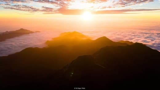
A 2,913 m summit — not a roadside stop but a two-day, one-night trek: leave the main road at Tú Lệ, follow the road towards Nậm Có to the trailhead, then hike through old-growth forest, bamboo and grassy ridges. Go with a local guide; you can stay at Mebayluon Clubhouse before and after the climb, and the porter will pick you up there. Best time: the dry season, roughly October to April.
Read more: Lùng Cúng Peak, 2,913 m: a 2-day trek from Tú Lệ, Mù Cang Chải
4. Lìm Thái village

Km 5.2 · elevation 750 m · 3.9 km from Tú Lệ market (about 5 min drive) · 1.9 km from Mebayluon Clubhouse (about 5 min).
A Thái village on the floor of the Cao Phạ valley: stilt houses, a clear stream and rice terraces curling around the houses. This is also the valley the paragliders from Khau Phạ fly down into — look up from the village and you will see the wings. Best time: water-pouring season in May–June, golden rice from mid-September to early October.
Read more: Lìm Thái village, Mù Cang Chải: Thái stilt homes below Khau Phạ
5. Paragliding landing field and Mebayluon Clubhouse

Km 5.9 · elevation 740 m · 4.7 km from Tú Lệ market (about 10 min drive).
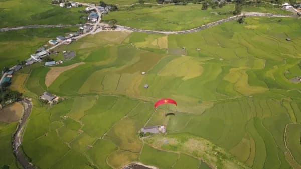
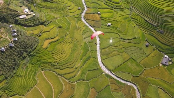
The paragliding landing field and Mebayluon Clubhouse are in Lìm Thái village, about 1 km off QL32 from the bản Lìm junction. Every flight from Khau Phạ lands here; from the clubhouse you can watch each wing spiral down among the rice terraces. Best time: tandem flights run all year when the weather allows; the valley is at its most beautiful in the water-pouring and golden seasons.
Read more: What's at the Khau Phạ paragliding take-off and landing field?
6. Lìm Mông village
Km 8.4 · elevation 1,080 m · 7.1 km from Tú Lệ market (about 15 min drive) · 5.1 km from Mebayluon Clubhouse (about 15 min).
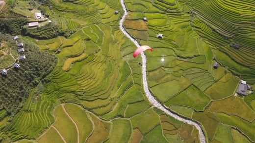
A Hmong village on the mountainside west of the Cao Phạ valley, some 300 m above Lìm Thái. From the road up to the village you look down over the whole valley of rice terraces below the pass — the area's best-known golden-season view. Best time: water-pouring season in May–June, golden rice from mid-September to early October.
Read more: Lìm Mông village: rice-terrace views below Khau Phạ Pass
7. Huy Thanh trout and sturgeon farm

Km 11.8 · elevation 1,090 m · 10.5 km from Tú Lệ market (about 15 min drive) · 8.5 km from Mebayluon Clubhouse (about 15 min).
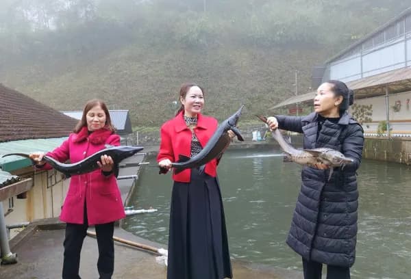
A sturgeon and trout farm beside a stream halfway up Khau Phạ Pass (bản Tà Chơ), quiet and well away from town, with a restaurant that cooks the fish on the spot alongside local ethnic dishes and Tú Lệ sticky rice. A good lunch stop before or after your flight. Best time: all year; best for lunch.
Read more: Huy Thanh trout and sturgeon farm on Khau Phạ Pass
8. Khau Phạ Pass paragliding take-off
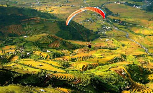
Km 15.2 · elevation 1,268 m · 13.9 km from Tú Lệ market (about 20 min drive) · 11.9 km from Mebayluon Clubhouse (about 20 min).
The paragliding take-off sits at 1,268 m, right on the edge of QL32 near the top of Khau Phạ Pass, looking straight down into the Cao Phạ valley. Stand at the edge and watch each wing launch into the void, or fly tandem yourself with a Mebayluon pilot down to the landing field in Lìm Thái. Best time: water-pouring season in May–June, golden rice from mid-September to early October; on sunny days there are sunrise and sunset flights.
Read more: Khau Phạ Pass: profile of a world top-10 paragliding site
9. Ngã Ba Kim

Km 30.4 · elevation 1,140 m · 29.1 km from Tú Lệ market (about 45 min drive) · 27.1 km from Mebayluon Clubhouse (about 45 min).
A junction (ngã ba) with a market, eateries, guesthouses and a petrol station at Púng Luông — the first place to restock after coming down the pass. From here a side road heads south up to the Púng Luông bamboo forest, while the main road continues up to La Pán Tẩn. Best time: all year; come down the pass while it is still light, as the top often fogs up in the late afternoon.
Read more: Ngã Ba Kim, Mù Cang Chải: the supply stop after Khau Phạ Pass
10. Púng Luông bamboo forest

Km 34.8 · elevation 1,320 m · 33.5 km from Tú Lệ market (about 55 min drive) · 31.5 km from Mebayluon Clubhouse (about 55 min).
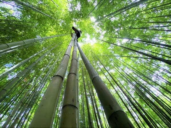
A bamboo forest on the mountain south of Ngã Ba Kim, with a narrow path winding between ramrod-straight stems. The bamboo stays green all year, so it rescues trips that miss the rice seasons; there is an entrance fee. Best time: all year, but avoid rainy days as the dirt slopes get very slippery.
Read more: Púng Luông bamboo forest, Mù Cang Chải: getting there and tips
11. Mâm Xôi hill, La Pán Tẩn

Km 36.9 · elevation 1,200 m · 35.6 km from Tú Lệ market (about 60 min drive) · 33.6 km from Mebayluon Clubhouse (about 60 min).
The round, terraced hill in La Pán Tẩn shaped like a tray of sticky rice (mâm xôi), less than 1 km off the main road — the most familiar image of Mù Cang Chải. To see the full concentric rings you need to stand on the opposite slope; there is an entrance fee. Best time: water-pouring season in May–June, golden rice from mid-September to early October; early morning and late afternoon light.
Read more: Big and little Mâm Xôi hills (La Pán Tẩn): water season and golden rice
12. Garrya Mù Cang Chải

Km 38.3 · elevation 1,100 m · 37.1 km from Tú Lệ market (about 55 min drive) · 35 km from Mebayluon Clubhouse (about 55 min).
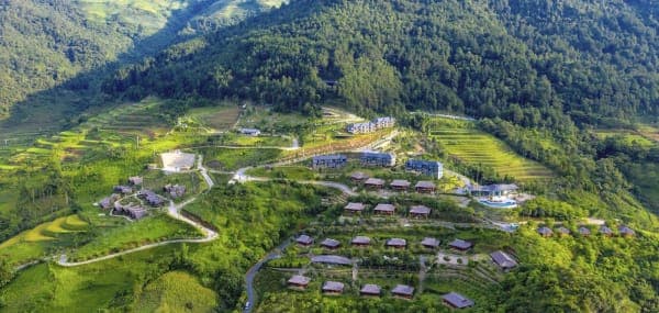
Banyan Group's Garrya Mù Cang Chải resort in bản Pú Nhu, in the middle of the La Pán Tẩn rice terraces. The handiest place to sleep if you want to be up on Mâm Xôi hill early, before the crowds. Best time: water-pouring and golden seasons — book early.
Read more: Garrya Mù Cang Chải: a resort amid the La Pán Tẩn rice terraces
13. Little Mâm Xôi hill

Km 41.2 · elevation 1,390 m · 38.3 km from Tú Lệ market (about 70 min drive) · 36.2 km from Mebayluon Clubhouse (about 70 min).
A small terraced hill high up to the north-east of La Pán Tẩn, far quieter than big Mâm Xôi. The way up has steep dirt sections that turn slippery in the rain: hire a local xe ôm and only go once the track has dried. Best time: water-pouring season in May–June, golden rice from mid-September to early October.
Read more: Big and little Mâm Xôi hills (La Pán Tẩn): water season and golden rice
14. Dinosaur Spine (Chế Cu Nha)

Km 46.1 · elevation 1,460 m · 44.9 km from Tú Lệ market (about 80 min drive) · 42.8 km from Mebayluon Clubhouse (about 80 min).
A narrow ridge on the Chế Cu Nha side: just over 4 km up from the main road, then a 15–20 minute walk. From the crest you can see the terraces of Dế Xu Phình, Chế Cu Nha, La Pán Tẩn and Mồ Dề all at once; don't go up after dark. Best time: water-pouring season in May–June, golden rice from mid-September to early October.
Read more: Dinosaur Spine, Mù Cang Chải: the way up and the viewpoints
15. Háng Sung bamboo forest (Mồ Dề)

Km 47 · elevation 1,310 m · 45.7 km from Tú Lệ market (about 75 min drive) · 43.7 km from Mebayluon Clubhouse (about 75 min).
The bamboo forest of Háng Sung village (Mồ Dề), the closest to town: a narrow path between tall stems, quiet and cool all year. Go early in the morning while it is empty and the light is still slanting; skip it after rain because the slopes get slippery. Best time: all year, avoiding rainy days.
Read more: Háng Sung bamboo forest, near Mù Cang Chải town
16. Centre of Mù Cang Chải commune

Km 47.7 · elevation 950 m · 46.4 km from Tú Lệ market (about 70 min drive) · 44.4 km from Mebayluon Clubhouse (about 70 min).
A small town beside the Nậm Kim stream at the end of the route, with a market, guesthouses, eateries and a petrol station. Stay the night here and head up to Horseshoe Hill, Kim Nọi or the bamboo forest the next day. Best time: all year; on golden-season weekends rooms fill up very early.
17. Horseshoe Hill (Vành Móng Ngựa)

Km 48.9 · elevation 1,210 m · 47.7 km from Tú Lệ market (about 75 min drive) · 45.7 km from Mebayluon Clubhouse (about 75 min).
A terraced hill curved like a horseshoe in Sáng Nhù village (Mồ Dề), just above town. It looks best in the afternoon light around 4 pm, when each terrace is half in sun, half in shadow; there is an entrance fee. Best time: water-pouring season in May–June, golden rice from mid-September to early October; afternoon light.
Read more: Horseshoe Hill, Mù Cang Chải: the best light and the road up to Sáng Nhù
18. Kim Nọi

Km 51.6 · elevation 1,240 m · 45.5 km from Tú Lệ market (about 90 min drive) · 43.5 km from Mebayluon Clubhouse (about 90 min).
A village on the mountainside south of town; the viewpoint is a rocky outcrop overlooking the whole valley of rice terraces. Quieter than Mâm Xôi and Horseshoe Hill, it suits anyone looking for a spot with few visitors. Best time: water-pouring season in May–June, golden rice from mid-September to early October.
Read more: Kim Nọi, Mù Cang Chải: a quiet rocky viewpoint over the terraces
When is the best time to visit Mù Cang Chải?
Mù Cang Chải is at its finest in the two seasons of the rice terraces: the water-pouring season and the golden season. The timing shifts every year with the weather and with altitude: terraces higher up usually ripen later than those in the valley, so on the same trip some fields can still be green while others have turned gold.
- Water-pouring season (around May–June): the terraces are being planted and the water channelled into them shines like a chain of mirrors down the mountainside. For flying in this season, see the water-pouring season seen from a Khau Phạ paraglider.
- Golden season (around mid-September to early October): the busiest time of year, when Mâm Xôi and Horseshoe Hill glow gold. Tú Lệ's cốm (young green sticky-rice flakes) season falls at the same time. The Golden Season paragliding festival at Khau Phạ Pass is held every year in late August – early September; see the Golden Season paragliding festival 2026.
- Tớ dày blossom season (around late December – February): the wild Himalayan cherry blooms pink across the hillsides; the weather is cold and often misty.
- Dry season (around October – April): the season for climbing Lùng Cúng.
- All year: the Púng Luông and Háng Sung bamboo forests, Tú Lệ's hot springs, and paragliding whenever the weather allows.
In the golden season, weekend rooms in Tú Lệ, La Pán Tẩn and central Mù Cang Chải fill up very early; book a few weeks ahead before fixing your dates. To avoid the crowds, go midweek.
Suggested self-guided Mù Cang Chải itineraries
The two itineraries below follow the order of the stops on the map and assume you take the night bus from Hanoi or drive up early. Paragliding depends on the weather, so keep a spare half-day.
Mù Cang Chải in 2 days, 1 night
- Day 1 – Tú Lệ and Khau Phạ Pass: arrive in Tú Lệ early, have breakfast and visit Lìm Thái village. Head up to the Khau Phạ take-off to paraglide or watch the wings launch (the morning session usually starts from 7–8 am). Lunch on Tú Lệ sticky rice or fish at the Huy Thanh farm. In the afternoon go up to Lìm Mông village for the valley view; in the evening soak in the hot springs and sleep in Tú Lệ or right at the landing field.
- Day 2 – La Pán Tẩn and central Mù Cang Chải: come down the pass early via Ngã Ba Kim, reach Mâm Xôi hill while the light is still soft, then the Dinosaur Spine (15–20 minutes on foot) and the Háng Sung bamboo forest. Lunch in central Mù Cang Chải and catch a bus back to Hanoi in the afternoon.
Mù Cang Chải in 3 days, 2 nights
- Day 1 – Tú Lệ: arrive in Tú Lệ, lunch on sticky rice, walk through Lìm Thái and Lìm Mông villages and watch the paragliders land at the landing field. In the evening soak at the Nước Nóng village hot spring or at Le Champ, and sleep in Tú Lệ or at Mebayluon Clubhouse.
- Day 2 – Khau Phạ Pass, Púng Luông, Horseshoe Hill: fly in the morning session and lunch on fish at the Huy Thanh farm. Over the pass, stop at Ngã Ba Kim and the Púng Luông bamboo forest. Around 4 pm head up Horseshoe Hill for the afternoon light, then sleep in central Mù Cang Chải or La Pán Tẩn.
- Day 3 – La Pán Tẩn and Chế Cu Nha: early morning on Mâm Xôi hill, then little Mâm Xôi (if the track is dry) or the Dinosaur Spine. If you like quiet places, add the Kim Nọi rock. Head back at midday and reach Hanoi in the evening.
Lùng Cúng Peak is a separate two-day, one-night trek and cannot be fitted into either itinerary. For a ready-made package with paragliding and accommodation, see the paragliding and homestay combo.
Where to eat and stay in Mù Cang Chải
What to eat in Tú Lệ and Mù Cang Chải
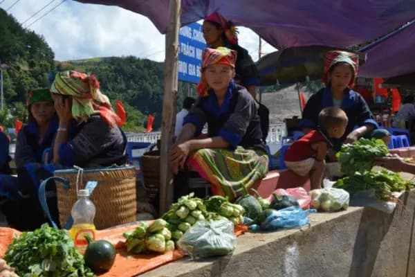
- Tú Lệ sticky rice (xôi) and cốm: a must at the start of the route; cốm is only available in the golden season. Food stalls cluster around Tú Lệ market.
- Trout and sturgeon: the Huy Thanh fish farm halfway up Khau Phạ Pass cooks the fish on the spot, with ethnic dishes and sticky rice.
- Thái and Hmong food: folded grilled stream fish (pa pỉnh tộp), grilled local pork, free-range hill chicken, bamboo shoots and wild greens; served at homestays, in Tú Lệ eateries and in central Mù Cang Chải.
- Mid-route supplies: Ngã Ba Kim has a market, eateries and a petrol station right after the descent from the pass.
To take home: Tú Lệ cốm (in the golden season), Tú Lệ sticky rice, Séng Cù rice and khẩu hang — sticky rice made from mature cốm of late-harvested glutinous rice, firmer and richer in flavour than ordinary cốm; there is also smoked buffalo jerky, wild honey and táo mèo (wild mountain apple). In Thái villages you will also find local pork grilled between bamboo with mắc mật leaves, and from about April to August, wild bee larvae stir-fried with sour bamboo shoots.
Where to stay in Mù Cang Chải
- Start of the route (Tú Lệ, Lìm Thái): Mebayluon Clubhouse is a Thái-style stilt house beside the stream, right at the paragliding landing field, with rooms and meals — ideal if you want to fly the early-morning session. Around it are the villagers' stilt-house homestays in Lìm Thái, and Le Champ Tú Lệ has hot-spring pools.
- Mid-route (La Pán Tẩn): Garrya Mù Cang Chải and the homestays around Mâm Xôi hill, handy for getting up the hill early.
- End of the route (central Mù Cang Chải): plenty of guesthouses, small hotels, eateries and a petrol station; convenient for Horseshoe Hill, Kim Nọi and the Háng Sung bamboo forest.
Choose your base according to the main purpose of your trip: if you are paragliding, sleep near the flying site; if you are chasing rice-terrace photos, sleep in La Pán Tẩn or central Mù Cang Chải. Every option is compared in where to stay when you fly Khau Phạ.
Paragliding at Khau Phạ Pass
The Khau Phạ take-off (stop 8) and the landing field at the Clubhouse (stop 5) are the two ends of a tandem paragliding flight: you launch from the edge of the road at 1,268 m, near the top of the pass, fly over the Cao Phạ valley and land among the rice terraces of Lìm Thái village, at 740 m. Passengers fly with a pilot and need no experience; each flight lasts about 10–15 minutes in the air.
You can fly in the morning and then carry on to La Pán Tẩn, or visit Mù Cang Chải first and come back to fly in the afternoon — both fit into one day. Mountain weather changes quickly, so flights can be rescheduled or cancelled with just a few hours' notice.
- Prices, flight times and flying weather: the Khau Phạ Pass paragliding page.
- Booking: book a paragliding flight at Khau Phạ Pass — all we need is the date, the number of people and a phone number.
- Choosing the season, preparing and safety: the Khau Phạ paragliding guide; cloud-chasing and sunset flights by powered paraglider: Khau Phạ paramotor.
Tips for a self-guided trip to Mù Cang Chải
- The side tracks up to little Mâm Xôi, the Dinosaur Spine and both bamboo forests have steep dirt sections that are very slippery after rain: don't take a scooter up — hire a local xe ôm.
- The top of Khau Phạ Pass is often foggy in the late afternoon and on early mornings in the cold season; time your descent while it is still light.
- The rice terraces are working fields: walk on the bunds, don't step on the rice, and carry your rubbish out.
- Days can be sunny, but evenings and early mornings are chilly, especially on the pass: bring a light jacket.
FAQ
Where is Mù Cang Chải, and which province is it in?
Mù Cang Chải is in the mountains of western Lào Cai Province; before the provinces were merged it belonged to Yên Bái. Today Mù Cang Chải is a commune whose centre is about 33 km from the Khau Phạ Pass paragliding take-off (in Tú Lệ commune). The main road up is QL32, via Nghĩa Lộ, Tú Lệ and Khau Phạ Pass.
How far is Mù Cang Chải from Hanoi?
From Mỹ Đình to central Mù Cang Chải is about 282 km via QL32, or 313 km if you take the Nội Bài – Lào Cai expressway to the IC14 exit. Tú Lệ is closer: 236 km via QL32.
What is the best month to visit Mù Cang Chải?
The finest times are the golden season, from about mid-September to early October, and the water-pouring season, around May–June. From late December to February the tớ dày blossom is out; the bamboo forests, hot springs and paragliding work all year round.
How many days do you need for Mù Cang Chải?
Driving straight from Tú Lệ to central Mù Cang Chải takes only about 70 minutes, but to stop along the way, fly and detour up to Mâm Xôi, Horseshoe Hill and Kim Nọi you need at least 2 days and 1 night — 3 days and 2 nights at a relaxed pace. Lùng Cúng Peak is a separate two-day, one-night trek.
Which sights in Mù Cang Chải charge an entrance fee?
According to the sources we checked, big Mâm Xôi hill, Horseshoe Hill (Vành Móng Ngựa) and the Púng Luông bamboo forest charge an entrance fee; prices change from year to year, so we don't quote a figure. We have found no record of fees at the other stops.
Is Mù Cang Chải worth visiting outside the rice seasons?
Yes. The bamboo forests are green all year, the hot springs are perfect on cold days, the dry season is the time to climb Lùng Cúng, and paragliding runs all year whenever the weather allows.
Where is Khau Phạ Pass, and is it a difficult drive?
Khau Phạ Pass is on QL32 between Tú Lệ and Mù Cang Chải, about 30 km long and fully paved; cars and buses use it without trouble. What to watch for are the many bends and the fog in the late afternoon and on early mornings in the cold season; in heavy rain, check road conditions before you set off.
Does the map work on a phone?
Yes. The 3D map runs directly in your phone's browser; on devices without 3D graphics support you still get a static map where you can tap each stop. The list of stops with directions, seasons, fees and a Google Maps button is in the check-in map section of the Khau Phạ Pass paragliding page.