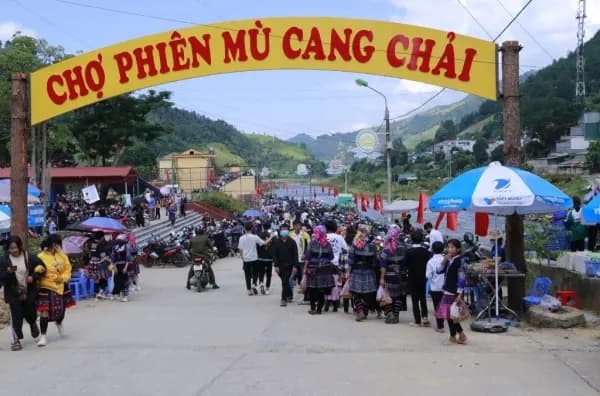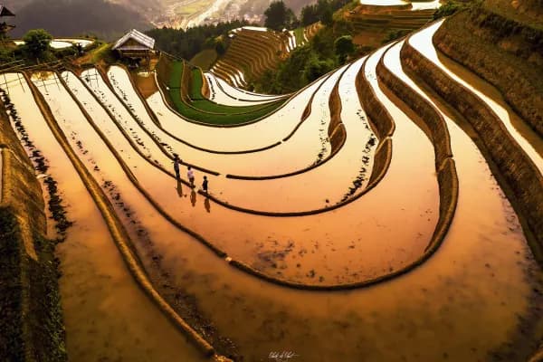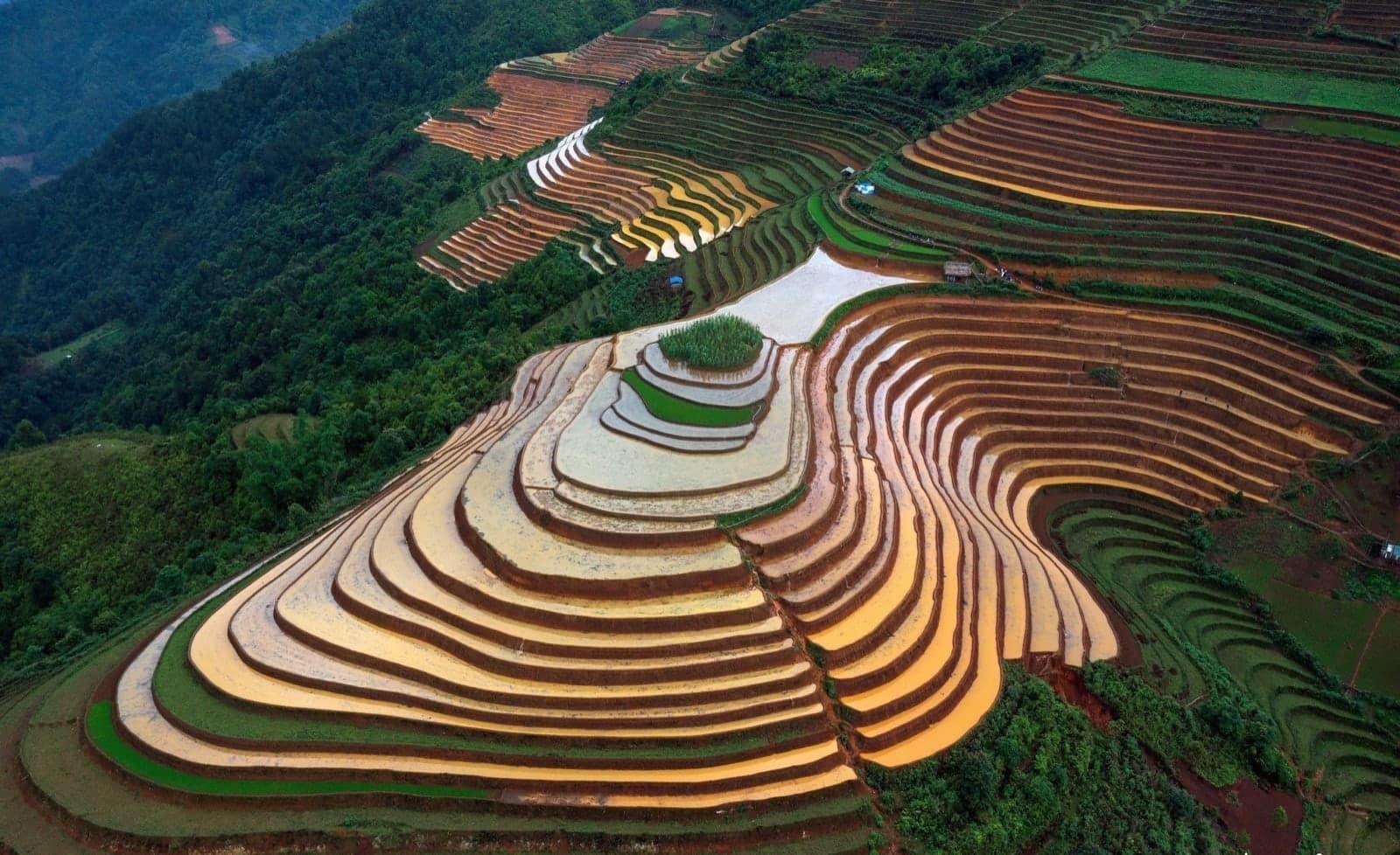
If Mù Cang Chải had an ID photo, it would be Mâm Xôi hill: a round hill wrapped in rice terraces, tier upon tier, like a festive tray of sticky rice (xôi) – hence its nickname, the "rice-bowl" hill. La Pán Tẩn actually has two hills by that name: big Mâm Xôi, right by the national road and the busiest stop on the route in the golden season, and little Mâm Xôi, higher up and rarely visited. On Mebayluon's check-in map, they are stops 11 and 13.
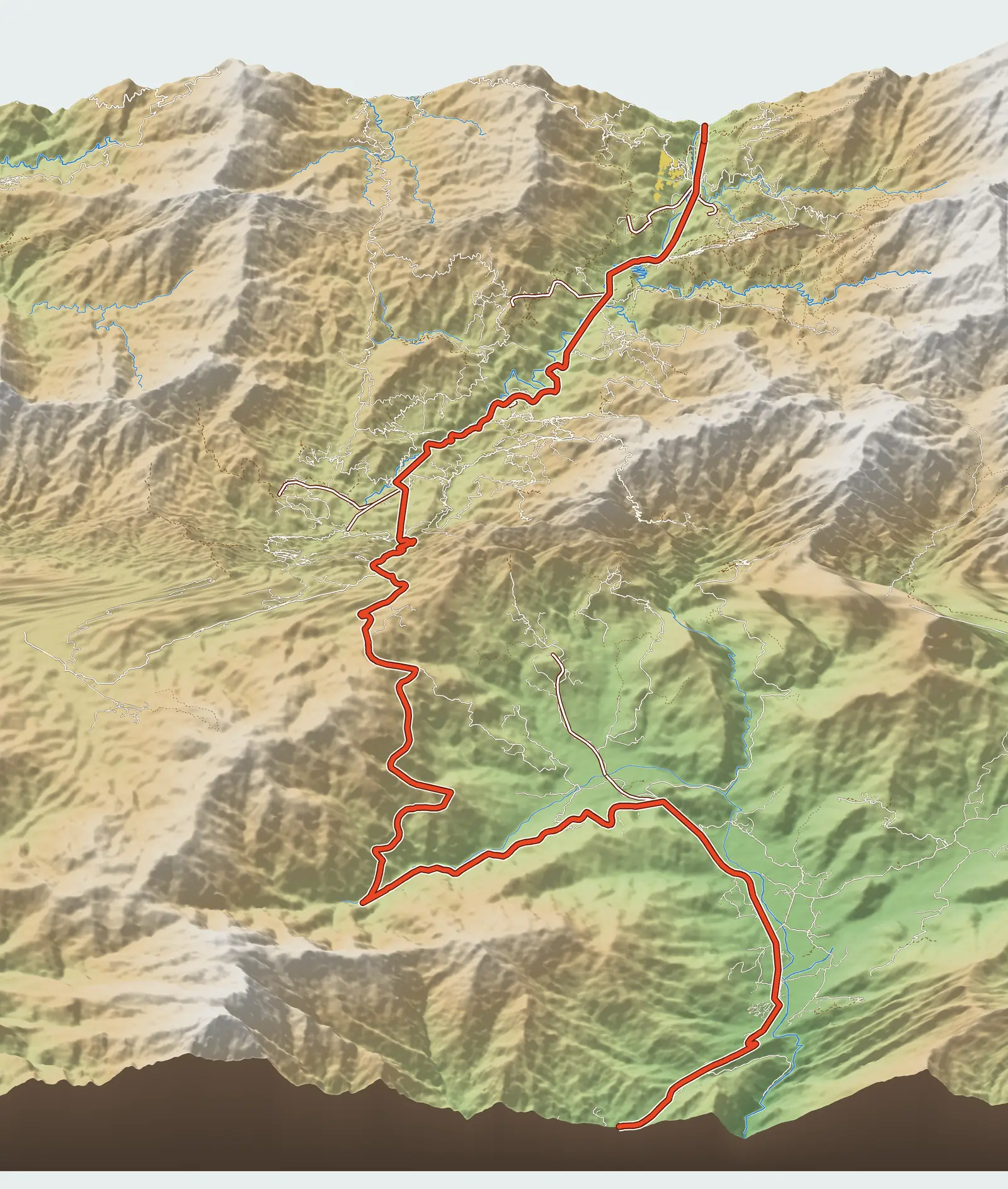
Where the two Mâm Xôi hills are
Both lie in La Pán Tẩn, now part of Púng Luông xã (commune). The rice terraces of three communes – La Pán Tẩn, Chế Cu Nha and Dế Xu Phình – with nearly 500 ha clustered in these tray-like shapes, were listed as a national scenic site in 2007 and later upgraded to a special national monument. The terraces were carved out by the Hmong (Mông) over many generations and are still farmed, one crop a year.
Big Mâm Xôi sits at around 1,200 m, with its turn-off at Km 36.1 on National Road 32 (QL32). Little Mâm Xôi is on the north-eastern mountainside at around 1,390 m, nearly 200 m higher; its road leaves the highway at Km 35.4, about 700 m before the big Mâm Xôi turn-off if you are coming from Ngã Ba Kim. As the crow flies the two hills are less than 2 km apart, but by road the trip is much longer.
Big Mâm Xôi
From Ngã Ba Kim (Kim junction), head towards town for just under 6 km to the turn-off at Km 36.1. From the highway it is about 800 m of side road to the viewpoint, steep at the end. In peak season you usually have to leave your vehicle below, then walk up or hire one of the Hmong xe ôm (motorbike taxi) riders waiting at the entrance. From Mù Cang Chải town it is about 11–12 km along the highway.
Guides give different walking distances, from just over 1 km to 2 km, depending on where you park and which tier of the hill you climb to. Allow plenty of time: give this spot at least an hour and a half on its own.
Where to stand to photograph big Mâm Xôi
What surprises first-timers: standing on Mâm Xôi hill itself, you cannot see the rice-bowl shape. To take in the full concentric rings, you need to stand on the opposite slope and look across. VnExpress also advises standing back to fit the whole hill in the frame. Walking down among the terraces is better for close-ups: curving dikes, rice-watch huts, harvesters at work.
Around the viewpoint you can rent traditional costumes and rice baskets for photos. If you want to photograph villagers working the fields, ask first.
Little Mâm Xôi
Little Mâm Xôi is the name backpackers gave to a small terraced hill shaped like big Mâm Xôi but higher up and far quieter. There is no official signpost and it is not yet in OpenStreetMap; the location on the check-in map is one Mebayluon has verified. The viewpoint is more than 400 m from the nearest road, so the last stretch is on foot or with a local guide.
According to the map, the side road leaves National Road 32 at Km 35.4, about 700 m before the big Mâm Xôi turn-off if you are coming from Ngã Ba Kim, then climbs about 5.8 km. This branch includes dirt roads and footpaths; the steep dirt sections become very slippery in the rain.
Counting the highway distance, little Mâm Xôi is at Km 41.2 on the check-in map – about 41 km from the Le Champ gate in Tú Lệ and about 36 km from Mebayluon Clubhouse in Lìm Thái village. Allow around 70 minutes' driving in dry conditions, not counting the final walk and stops to ask the way.
So the most practical advice: don't drive up yourself unless you are used to steep dirt roads. Hire a local xe ôm at the foot of Mâm Xôi hill – the riders know the way and whether the road is passable that day. The final walk is not long: the hike to the viewpoint has been logged at about 1.3 km round trip, with roughly 80 m of climb and descent. A local xe ôm from the foot of Mâm Xôi hill up to little Mâm Xôi cost about 200,000 VND return, according to a 2022 guide; prices change with the season, so agree on one beforehand.
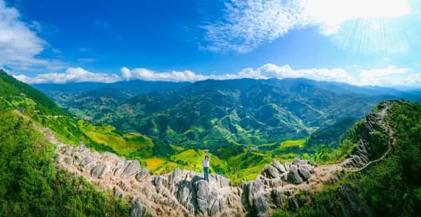
The view from little Mâm Xôi is wider than from big Mâm Xôi: rice terraces layered against the forest, with the valley below. Because few people know about it, you can easily get a shot with no other visitors in it. Some compare the scenery here to the Dinosaur Spine (Sống Lưng Khủng Long), another quiet spot not far away.
In the water-pouring season (when the terraces are flooded for planting), the whole area around the two Mâm Xôi hills turns into tiers of mirrors. Higher fields such as little Mâm Xôi tend to be planted a little later than those lower down, so there are still flooded terraces to see in late June.
Water-pouring season and golden season
The water-pouring season falls around May–June. The Hmong rebuild the dikes and channel water from mountain streams into the fields to plough, sow seedlings and then transplant them; each terrace becomes a mirror that changes colour through the day. This season is less dazzling than the golden one – more subdued and wild, and with fewer visitors.
The golden season runs from about mid-September to early October. Higher fields usually ripen later than lower ones, so in some years little Mâm Xôi turns gold a few days after big Mâm Xôi. Both early-morning and late-afternoon light make for great photos; photographers are often in place before 5 am or after 4:30 pm. The afternoon sun disappears quickly in this valley, so arrive half an hour earlier than you planned.
Practical tips
- Big Mâm Xôi charges an entrance fee; sources give different amounts (it changes from year to year), so we don't quote a figure. We have found no source mentioning a fee at little Mâm Xôi; if someone asks you to pay, ask for details.
- On golden-season weekends big Mâm Xôi gets very crowded. For a quieter visit, go on a weekday or very early.
- The road to little Mâm Xôi has steep dirt sections: don't go while it is raining or just after rain, don't go near dusk, and preferably go with a villager or local xe ôm, agreeing on the return fare beforehand.
- Walk on the dikes and don't step on the rice. These are fields people grow food in.
- Bring drinking water, and tell someone staying behind where you are going and when you'll be back.
Combine it with a paragliding flight
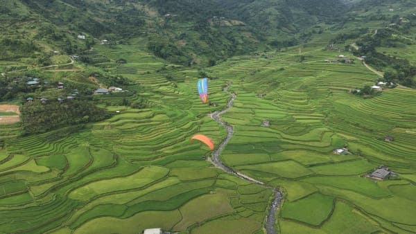
From the Khau Phạ Pass paragliding take-off to the Mâm Xôi turn-off is 21 km. A good day might look like this: fly over the Cao Phạ valley in the morning, cross the pass at midday, and stand at Mâm Xôi in the late-afternoon sun. You'll see rice terraces from both angles, from the sky and from the ground, on the same day.
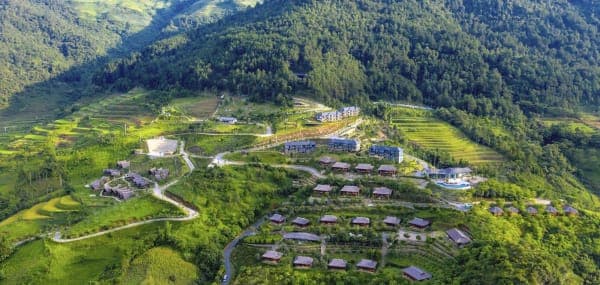
Little Mâm Xôi suits those who have already flown, seen big Mâm Xôi and still have a dry half-day to spare. If you want to get up there early, staying in La Pán Tẩn is most convenient: Garrya Mù Cang Chải is at Km 38.3, about 3 km of highway from the little Mâm Xôi turn-off, whereas staying in town means driving back more than 12 km.
FAQ
What is the difference between big and little Mâm Xôi?
Big Mâm Xôi is close to the highway, easy to reach, busy and charges a fee. Little Mâm Xôi is nearly 200 m higher, with a longer, steeper way up; it is quiet and the view is wider, but only go when the road is dry.
How far is it from big Mâm Xôi to little Mâm Xôi?
Less than 2 km as the crow flies. By road: the two turn-offs on the highway are about 700 m apart, then from the Km 35.4 turn-off it is another 5.8 km or so of side road up to little Mâm Xôi.
When is the best season to visit Mâm Xôi?
The water-pouring season around May–June and the golden season from about mid-September to early October. The golden season is the busiest; the water-pouring season is quieter and suits those who love reflection shots.
Previous and next stops on the route
- Previous stop: Púng Luông bamboo forest, 2.1 km from big Mâm Xôi by map kilometre.
- Between the two hills: Garrya Mù Cang Chải (stop 12).
- Next stop after little Mâm Xôi: Dinosaur Spine (Sống Lưng Khủng Long), 4.9 km on by map kilometre.
- The whole route: 18 stops, kilometre markers, best seasons and a dedicated post for each in Mù Cang Chải Travel Map: 18 Stops from Tú Lệ to Khau Phạ.