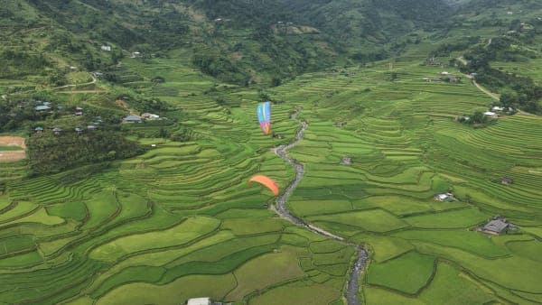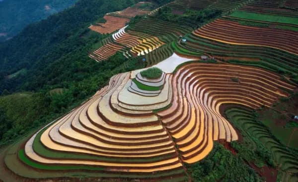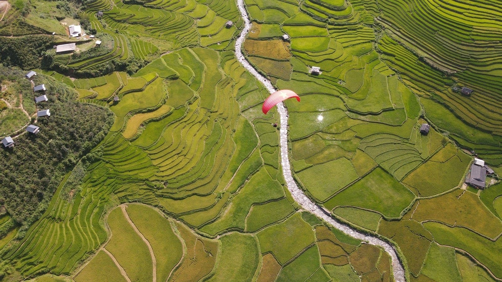
If you had to pick one photo to sum up the golden season on the Tú Lệ side of Mù Cang Chải, many people would choose the Lìm Mông valley: rice terraces spilling from the mountainside right down to the stream, with Khau Phạ Pass above. Lìm Mông village is stop no. 6 on Mebayluon's check-in map.
Where is Lìm Mông village?
Lìm Mông is a Hmong (Mông) bản (village) in the former Cao Phạ xã (commune). It clings to the mountainside on the western flank of the Cao Phạ valley, at around 1,080 m, some 300 m above Lìm Thái village on the valley floor. The two villages are not far apart but could hardly be more different: below, the stilt houses of the Thái (Thai ethnic group) beside the stream; above, Hmong homes set among the rice terraces.
The road up
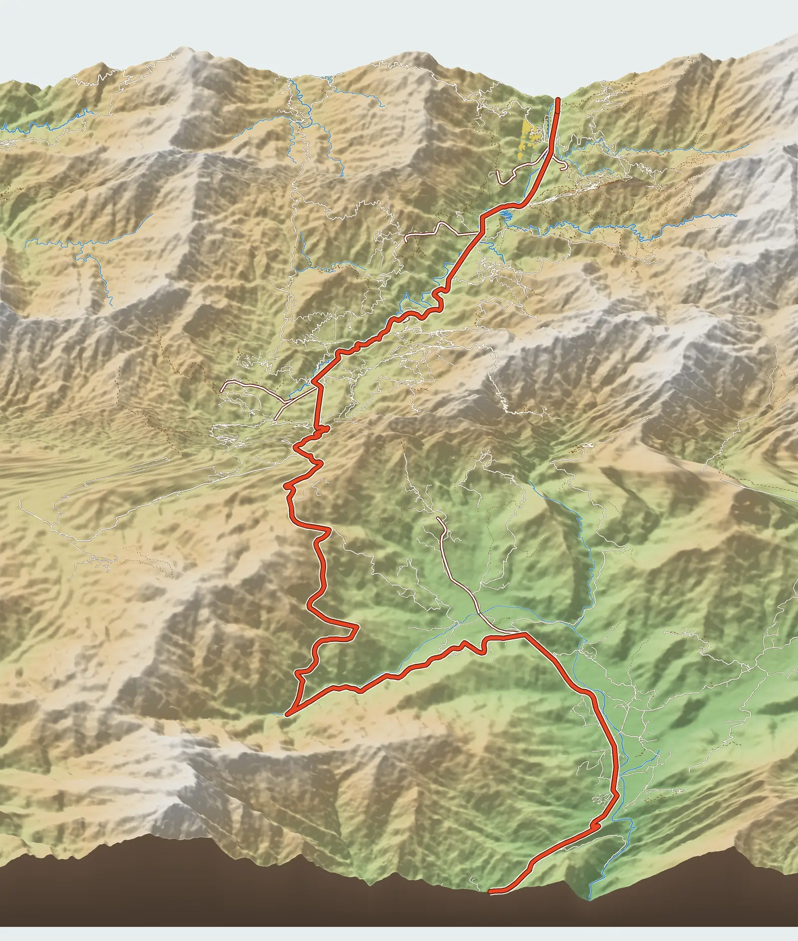
No road climbs straight from QL32 to Lìm Mông. You turn off at the Lìm Thái entrance (Km 4.6), go through the village, past the paragliding landing field, across the stream, and only then start climbing. Including the turn-off, it is 3.8 km from the main road to the village; on the map this stop sits at Km 8.4.
The climb is steep and narrow. Older guides describe a bumpy red-dirt track, dusty in the dry season and slippery in the rainy season; one likened the slope to a thread flung up into the sky. The road surface changes from year to year, but the gradient stays the same. Riders not used to mountain roads should leave their bike in Lìm Thái and hire a xe ôm (motorbike taxi) from the village, or walk up if they have time.
Viewpoints
You don't need to go all the way up to the village. Many bends along the climb open onto a full panorama: terraces stepping down to the stream, Lìm Thái shrinking on the valley floor, and across the way the mountainside where QL32 snakes up to the pass. The Lìm Mông slope faces east, so the morning sun hits it head-on and lights the fields evenly; in the afternoon this side falls into shadow early. For photos that show every terrace clearly, go up before midday.
Turn it around and Lìm Mông is also the view you get from the paragliding take-off on Khau Phạ Pass: VnExpress described the pass looking down on the rice terraces of the villages in the valley. Anyone who has flown will recognise this as the most beautiful stretch of terraces they have just glided over.
Best seasons and times
The water-pouring season (when the terraces are flooded for planting) falls in May–June, when the Hmong channel water into the fields to transplant rice. The golden season runs from about mid-September to early October. The upper fields usually ripen a little later than those on the valley floor, so on some days you can look down and see green and gold side by side. We have written a separate piece on paragliding over the Lìm Mông valley in the water-pouring season.
A morning in Lìm Mông: Hmong pipes, beeswax drawing, indigo dyeing
Up in the village, the old Hmong crafts live on in every household. The elderly men still play the khèn, the Hmong pipes made from long bamboo tubes. The women draw patterns on cloth with hot beeswax and then dye it in indigo: the waxed areas stay white, leaving patterned lines on an indigo background, before the cloth is sewn into skirts and embroidered jackets.
The village has no ready-made tourist services. If you would like to hear the khèn or try wax drawing, ask Mebayluon Clubhouse down in the valley to arrange it in advance, and ask permission before photographing villagers.
Practical tips
- Don't ride up yourself on rainy days or right after rain.
- Use a low gear going downhill rather than riding the brakes.
- There are few shops in the village; bring water, and head back down to Lìm Thái or out to Tú Lệ to eat.
- In peak season, pull well onto the verge at bends so you don't block villagers on their way to the fields.
Combine it with a paragliding flight
Flying and walking give you two views of the same valley. From under the wing, the Lìm Mông terraces are contour lines curving beneath your feet; up in the village, you stand among those very lines and look up at the gliders passing overhead. Since the landing field lies right on the road up to the village, the most natural combination is to go paragliding at Khau Phạ in the morning, land, then carry on up to Lìm Mông before the sun gets too harsh.
Previous and next stops on the route
- Previous stop: the paragliding landing field and Mebayluon Clubhouse, 2.5 km away by the map's km markers.
- Next stop: Huy Thanh sturgeon and trout farm, 3.4 km away by the map's km markers.
- The whole route: 18 stops, distances, best seasons and a dedicated post for each in Mu Cang Chai Travel Map: 18 Stops from Tu Le to Khau Pha.