Ha Giang (part of Tuyen Quang province since July 2025) is known for its karst plateau, dizzying mountain passes and hill-tribe markets. For active travellers it is also a rare adventure playground: flying over limestone valleys, climbing the province's highest summits, hiking along the Ma Pi Leng cliffs or running trail races through the mountains. This guide gathers the seven experiences most worth trying, with difficulty, best seasons and safety notes updated to November 2026.
| Experience | Where | Time needed | Fitness, experience | Best season |
|---|---|---|---|---|
| Tandem paragliding | Quan Ba, about 45 km from Ha Giang city | 9–15 minutes in the air | No experience needed | Year-round when the weather allows, best in autumn |
| Paramotor flight (PPG) | Quan Ba valley, by the Mien river | 15 or 20–25 minutes | No experience needed | Cloud-chasing in spring and summer; sunrise, sunset |
| Tay Con Linh trek | Vi Xuyen, about 22 km from Ha Giang city | 2 days, 1 night, over 17 km | Good fitness, local guide advised | October–November and March |
| Sunrise above the clouds on Chieu Lau Thi | Hoang Su Phi | About 800 m on foot, 30–40 minutes | Easy, but a very early start | Early mornings on clear days |
| Sky Path hike | Ma Pi Leng pass | 2–3 hours | Moderate, sure footing needed | Dry days |
| Ha Giang Loop by motorbike | Quan Ba – Yen Minh – Dong Van – Meo Vac | 3–4 days | Confident on mountain roads, or ride with an easy rider | Avoid rain and fog |
| Ultra Trail Ha Giang | Meo Vac | Trail 25–70 km | Very high, training required | Early April |
1. Tandem paragliding over the Quan Ba valley
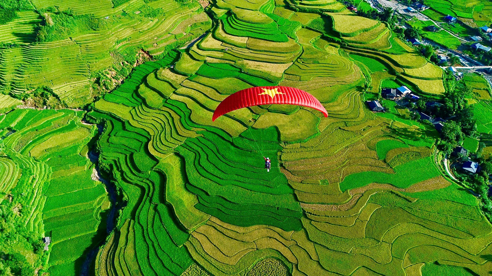
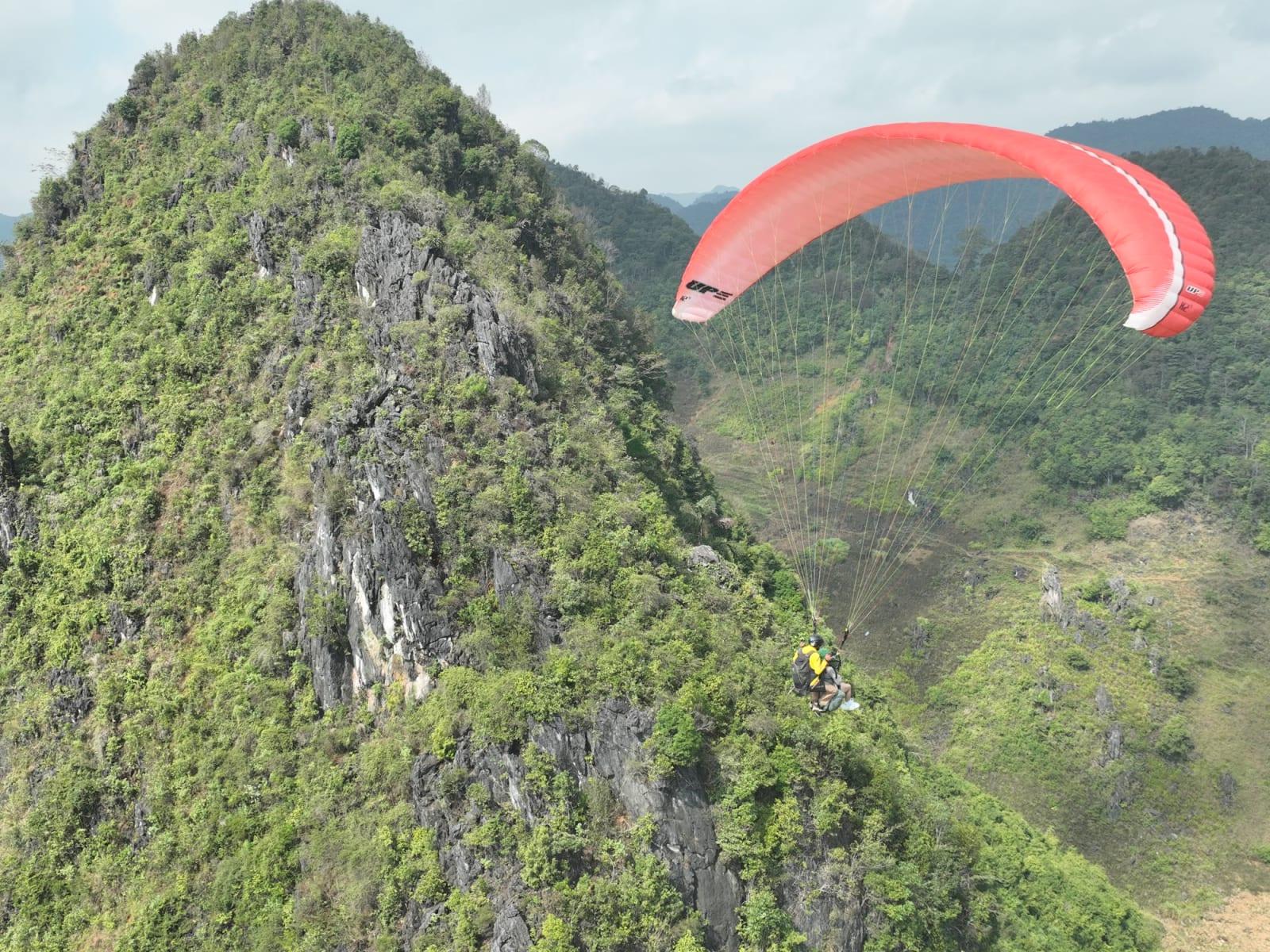
This is the most accessible "adventure" in Ha Giang: you don't need to know how to fly or be especially fit. You fly with a certified pilot who controls the whole flight. The take-off is on a hillside at about 950 m, a few kilometres from central Quan Ba. After a few running steps the wing lifts you both, and for 9–15 minutes (depending on the wind) you glide along the limestone slopes, looking down on maize and sugarcane fields, villages and the Mien river.
The highlight is gliding past Quan Ba's distinctive pointed limestone peaks, then heading out over the middle of the valley, where the fields form a patchwork of colours. The flight ends at the landing field in the valley, at about 450 m, between sugarcane fields by the Mien river. The ticket includes transfers within the Quan Ba area, GoPro photos and video, and insurance; prices for each package are in the Ha Giang paragliding price guide. Besides regular flights there is a sunset package, the most sought-after time slot.
2. Paramotor: taking off from the valley floor
Paragliding depends on the wind on the hillside; a paramotor (powered paraglider, PPG) is far more independent. The motorised trike takes off straight from the field in the valley, the pilot climbs under power and takes you around the peaks and side valleys of Quan Ba. There is a 15-minute basic flight and a 20–25-minute flight at sunrise, at sunset or chasing the clouds while they still fill the valley. If the weather does not allow a cloud-chasing flight that day, it becomes a basic flight. Quan Ba and Khau Pha are the only two sites in northern Vietnam offering paragliding, paramotor and training; the two are compared in Khau Pha or Quan Ba.
3. Trekking Tay Con Linh, the roof of Ha Giang
Tay Con Linh rises to about 2,420 m (sources give 2,419–2,431 m), the highest summit in Ha Giang. The usual route starts from Mao Phin village (Vi Xuyen): about 15 km from Ha Giang city to Phuong Tien, then roughly 7 km of concrete road. The standard trek is 2 days and 1 night, over 17 km in total: about 13 km on day one to the campsite, then the last 4 km to the summit the next morning, roughly 3 hours, before heading down.
- The last 3 km are very steep, overgrown, with many misleading side paths. First-timers should hire a local guide or porter, or join a tour.
- The forest has leeches, mosquitoes and snakes, and the trail turns very slippery in rain. Bring hiking boots, leech socks, a rain jacket and warm layers for the night.
- Best in October–November (red leaves, ripe rice below) and March (rhododendron season).
4. Above the clouds on Chieu Lau Thi
Chieu Lau Thi (about 2,402 m, Hoang Su Phi) is Ha Giang's second-highest summit but far easier to reach: a concrete road takes you close to the top, leaving about 800 m of stone steps on foot, 30–40 minutes. The challenge is the timing: to see the sea of clouds below you need to set off around 4 a.m., while it is still dark and cold. It suits anyone who wants the feeling of standing above the clouds without the time or fitness for a long trek.
5. Hiking the Sky Path along the Ma Pi Leng cliffs
The Sky Path is a hiking trail hugging the cliffs of the Ma Pi Leng pass, looking straight down into the Nho Que river canyon. It takes 2–3 hours, is free and needs no guide, but some sections run along the drop, so only go on dry days and with sure footing. Note: the "selfie rock" viewpoint (Skywalk) in Ma Pi Leng hamlet has been closed to visitors since 1 July 2026 for safety and infrastructure upgrades, until further notice. Ask the commune authorities or your homestay about trail conditions before setting off. The route is described section by section in Ma Pi Leng Sky Path.
Below the pass, a boat trip on the Nho Que river through the Tu San canyon is the gentler add-on for the same day. Boats are run by a local cooperative, life jackets are compulsory for the whole trip, and the service stops when the river floods. Piers and schedules are in the Nho Que river boat guide.
6. Riding the Ha Giang Loop by motorbike
The Quan Ba – Yen Minh – Dong Van – Meo Vac loop, with the Tham Ma and Chin Khoanh slopes and the Ma Pi Leng pass, is northern Vietnam's most famous motorbike route, and the riskiest part of a trip if taken lightly. After an accident that killed a foreign visitor in April 2026, the Tuyen Quang Department of Culture, Sports and Tourism required motorbike tours to be sold only by licensed travel companies, with a contract naming the driver, the bike and the route; riders must have helmets and protective gear and the bikes regular servicing. To ride yourself you need the right licence class; if you are not used to mountain passes, ride pillion with an easy rider. The two options are compared in easy rider or self-ride, and the paragliding stop on day one of the Loop is in Paragliding on the Ha Giang Loop.
7. Running the Ultra Trail Ha Giang
For runners, the Ultra Trail Ha Giang and Ha Giang Discovery Marathon is an annual race held in early April. The 7th edition took place on 3–5 April 2026 in Meo Vac with nearly 400 athletes: trail distances of 25, 42, 55 and 70 km across the karst mountains, and road distances of 6, 12 and 21 km on the mountain passes. Long trail distances demand months of serious training; check the organisers' official channels for the 2027 registration dates.
Putting it together: a 4-day trip
- Day 1: Ha Giang city → Quan Ba (about 45 km). Tandem paragliding or a sunset flight in the afternoon; overnight in Quan Ba.
- Day 2: an early paramotor flight chasing the clouds (if there are any), then on to Yen Minh and Dong Van via the Tham Ma and Chin Khoanh slopes.
- Day 3: the Sky Path in the morning, a Nho Que river boat trip in the afternoon, then Meo Vac or Dong Van for the night.
- Day 4: back to Ha Giang city. For Tay Con Linh or Chieu Lau Thi, add 2 separate days: both peaks lie to the west, outside the Loop.
General safety notes
- Choose licensed, insured operators. For paragliding, ask what certification the pilot holds; for motorbike tours, ask for the contract the province now requires.
- The weather decides. Strong wind, rain or storm clouds mean postponing flights and climbs. Being ready to reschedule is the safest choice.
- No alcohol before flying, riding or climbing, not even a "warming" cup of local corn liquor.
- From November to February the plateau is very cold, sometimes below 5 °C at dawn: pack a windbreaker, warm layers and gloves. In the rainy season (roughly June–August) watch for landslides on the passes.
- Informal spots (rock outcrops, sinkholes, undeveloped cliffs) are not managed attractions. Check with the commune authorities before going.
If you pick just one experience for your Ha Giang trip, paragliding or a paramotor flight at Quan Ba delivers the thrill anyone can try. Flight times, packages and booking are on the Ha Giang (Quan Ba) flying site page. Certified pilots who want to fly here themselves can read Flying Quan Ba: site briefing.