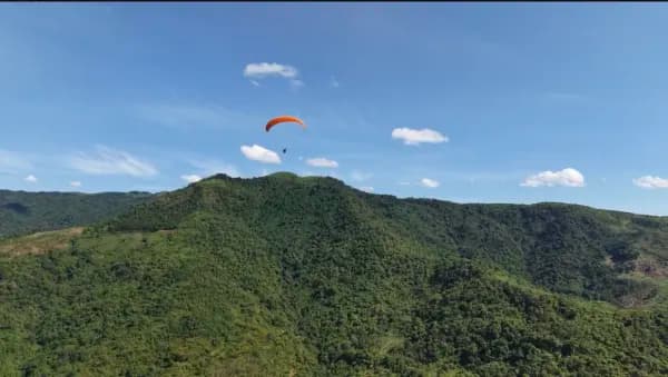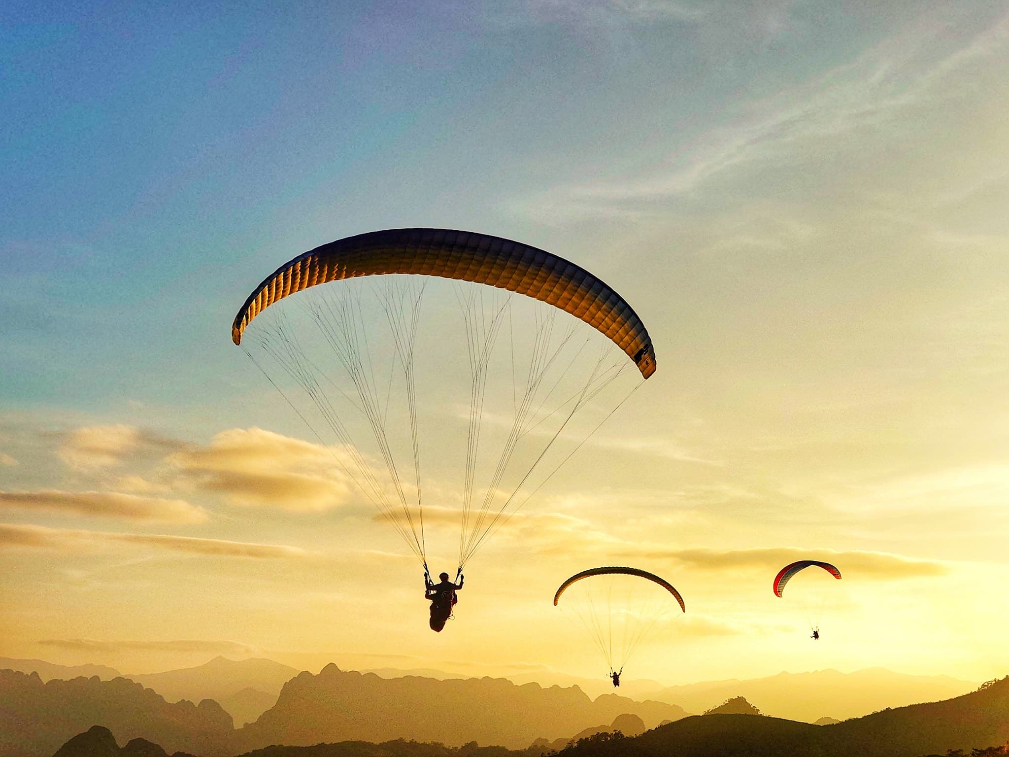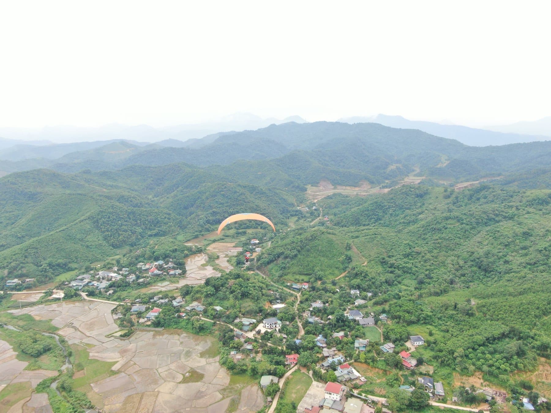
Vien Nam is the site near Hanoi that faces south — the exact opposite of Doi Bu, about 20 km away. On a northerly day Doi Bu works and Vien Nam does not, and vice versa. This briefing is for solo pilots (P2 and up, including visiting pilots): what the site rules require, how to read the wind using the site operator's direction ranking, and how to handle launch, lift and landing approach in each wind direction.
Vien Nam at a glance: the numbers to remember
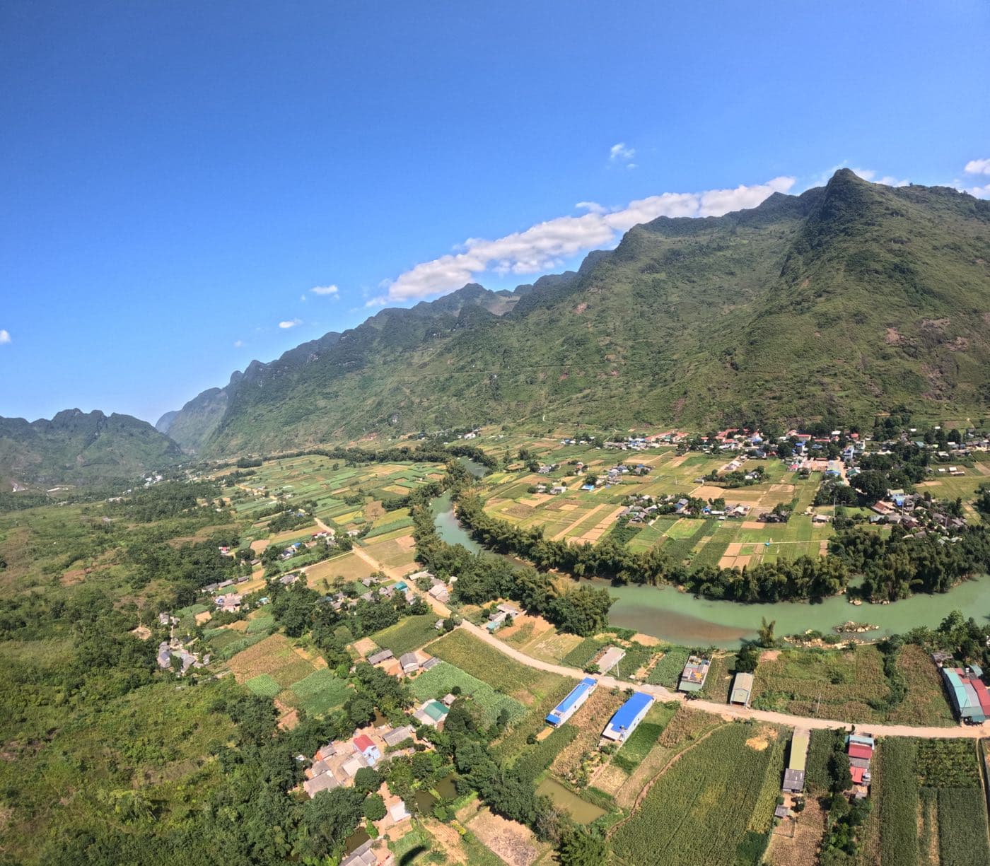
According to the map on the site's 2026 rules sign, Vien Nam has two take-offs (TO 1 and TO 2) on the mountainside, marked at 600 m, and two landing fields (LZ 1 and LZ 2) in the valley at about 50 m, south-west of the take-offs and right next to the road along the foot of the mountain. The summit is about 1,050 m. Before you launch, find the landing field from take-off and judge your glide to it.
A note on altitudes: Mebayluon's other guides and the site's weather table use take-off levels of 650 m and 850 m, which differ from the 600 m printed on the sign. This briefing follows the rules sign. When you register, ask the site operator which take-off is in use that day and its exact altitude (AMSL) — the ceiling is measured from the take-off.
| Item | Details |
|---|---|
| Take-offs | TO 1 and TO 2, marked 600 m AMSL on the sign |
| Landing fields | LZ 1 and LZ 2, about 50 m AMSL, south-west of take-off, next to the road |
| Launch directions (sign) | East, South, West |
| Ceiling | 200 m above take-off |
| No-fly areas | Hoa Lac airport; Hoa Binh hydro dam zone, radius 10 km |
| High-voltage line | Crosses the southern part of the flying zone — never fly over it |
| Radio | 170.500 (HNAA) & 148.770 (HNPG) |
| Emergency | 097.677.1204 (Mr. Ngu) |
| Flight registration hotline | 0964.073.555 |
Rules and airspace
The authorised flying zone is the yellow area on the map, straddling the Hanoi – Hoa Binh boundary. To the north-east lies Hoa Lac airport, to the south-west the Hoa Binh hydro dam zone with a 10 km radius — both are no-fly areas. The ceiling is 200 m above take-off: on a good thermal day you will reach it quickly, so decide before launching where you will leave the thermal and how you will lose height.
- Register before you fly — no flying without registration. Use the flight register page or the hotline 0964.073.555.
- Mandatory equipment: helmet, radio, reserve parachute. Missing any one of them means no flight.
- Certified equipment, periodically inspected.
- P2 pilots or below (or equivalent), with fewer than 50 flights or less than 15 hours, must fly under instructor supervision.
- Do not fly in poor visibility, in bad conditions, into areas with hazard warnings, near power lines, or outside the permitted zone.
- Radio: 170.500 (HNAA) and 148.770 (HNPG). Emergency: 097.677.1204 (Mr. Ngu).
- The sign recommends an SIV course and a first-aid course every year.
Reading the wind: the site's direction ranking
The rules sign lists three launch directions: East – South – West. For solo pilots, the site operator ranks the wind in more detail across 16 directions — the same table the flight register page uses to rate each day. Vien Nam faces south, so any wind from the northern half is a tailwind.
| Main wind | Rating | Notes |
|---|---|---|
| S | Very good | Straight onto the slope, into the take-off |
| SSE | Good | |
| SSW | Fairly good | |
| E, ESE, SE | Flyable | Thermals do not come up at take-off; they are pushed out toward the landing field |
| SW | Flyable | Not as good as the southerly sector |
| WSW, W, WNW, ENE | Outside the site's directions | Not recommended for solo pilots |
| NW, NNW, N, NNE, NE | Tailwind | No flying |
Wind strength: 3–4 m/s at take-off level is ideal; 2–5 m/s is usable; 5–6 m/s is strong and only for confident pilots; above 6 m/s is too strong — no flying. The operator set this scale for Doi Bu; Vien Nam has no scale of its own yet, so the same one applies. These figures are the mean wind, not gusts — a gusty day needs its own judgement even when the mean looks fine.
Scenario 1: S, SSE, SSW — the best conditions
This is Vien Nam's on-slope wind: it blows straight into the face that holds the take-off. At 3–4 m/s a reverse launch is the natural choice: inflate, check the wing is fully pressurised overhead, turn and step off decisively. Below 2 m/s, use a forward launch with a proper run. As it approaches 5–6 m/s, get someone to hold the wing while you lay out and control it on the rear risers so you are not dragged back up the slope.
The lift is right in front of take-off: ridge lift when there is enough wind, plus thermals when the sun is out. Ridge soar in figure-eights, always turning away from the slope, and keep enough clearance that you never need deep brake to turn. Once you are in a thermal, remember the 200 m ceiling above take-off: leave the thermal before it, fly out in front and use big ears if you need to come down — do not let a thermal carry you through the ceiling or drift you behind the mountain.
The classic mistake in a southerly: the wind builds during the day past 6 m/s and the pilot keeps scratching the ridge. As the wind strengthens, the ridge-lift band moves back toward the crest while your penetration drops — you can be blown back over the ridge into the lee on the north side, where there is nothing but rotor. Signs it is time to leave: groundspeed flying out close to zero, the windsock horizontal and snapping. Push the speed bar, fly straight out over the valley and head for the landing field.
Landing approach: a southerly at the landing field means your final leg points south, into wind. Fly a U-approach (downwind – base – final) with height to spare and turn final early. The landing fields sit next to the road and houses: plan the circuit so you never have to cross the road, roofs or the tree line on the upwind side of the field at low height.
Scenario 2: E, ESE, SE — flyable, but the thermals are not at take-off
According to the site ranking, E, ESE and SE are flyable but not as good as the southerly sector. The key difference: thermals do not come up at take-off — they are pushed out toward the landing field. Do not expect long ridge-soaring sessions in front of take-off as on a southerly day.
At take-off this wind arrives at an angle — there is a crosswind component. Read the windsock and streamers carefully and lay the wing out facing the wind actually blowing up the slope, not the fall line. A crosswind lifts one side of the wing first: inflate, stabilise the wing overhead, correct with the brakes and step under it before you run. If the wing is not stable, abort and lay out again.
Once off the hill, treat the flight as a glide toward the landing field and look for thermals on the way, over the open ground in front of the landing area — that is where this wind tends to put them. Do not sink low over forested slopes chasing weak lift: in an easterly, the west faces of the spurs are in the lee, turbulent and sinking. Always keep enough height to glide to the landing field.
Landing approach: read the landing windsock before you set up your circuit — in an easterly, final points east. The valley wind can differ from the wind at take-off; always land on what the landing windsock says, not on what you launched in.
Scenario 3: SW, W — only when light, and only with experience
SW is still flyable in the site ranking. WSW and W, although West is one of the three launch directions on the sign, are rated by the operator as outside the site's directions for solo pilots — not recommended. The wind comes in at an angle from the west, so all the crosswind advice from scenario 2 applies in mirror image: this time the east faces of the spurs are in the lee.
If you launch in a south-westerly, set yourself tight limits: light, steady wind, and the landing windsock agreeing with the take-off. Fly straight out to open ground and never sink low behind a spur. Land with your final leg into whatever wind the landing windsock shows.
Northerly winds: tailwind — no flying
NW, NNW, N, NNE and NE blow from behind the take-off. Launching downwind off a slope is genuinely dangerous, and the air in front of take-off is then in the lee, full of rotor. On a northerly day go to Doi Bu instead — a north-facing site about 20 km away.
Two traps. First, rotor behind a mountain can push air back up the lee face, so the take-off windsock looks like an on-slope wind while the real wind is northerly. Always cross-check the take-off windsock against the landing windsock, cloud drift and the upper-wind forecast before you trust it. Second, the wind sometimes swings during the day: northerly in the morning, then into a flyable direction for a few hours. Use the hourly forecast to see when it might turn — then wait until it actually turns on site rather than going by the forecast clock.
Seasons and the daily cycle around Hanoi
Vien Nam is Mebayluon's main site from January to August, when southerly winds dominate; from September to December northerlies are more frequent and Doi Bu takes over. The climate picture behind that:
| Period | Typical wind | For Vien Nam |
|---|---|---|
| Winter monsoon (roughly Nov – Apr) | Cold surges arriving in waves, NE and N winds | Cold-surge days are tailwind days — go to Doi Bu. Early and late in the season, storms and sudden strong wind can arrive 1–2 hours ahead of the cold front |
| Between cold surges (monsoon breaks) | Warm, humid SE wind | Vien Nam works again, but expect haze, inversions and poor morning visibility |
| Summer monsoon (roughly mid-May – mid-Oct) | SW, S, sometimes SE | On-slope season; strong thermals, but afternoon heat and orographic thunderstorms |
- Morning: a low hill on the edge of the plain like Vien Nam often sits inside the inversion; morning haze clears later than on high mountain sites. Morning air is usually smooth, thermals weak.
- Late morning to early afternoon: thermals build; around 14:00–15:00 thermals and wind peak — also when cumulus is most likely to overdevelop into thunderstorms on a humid day.
- Summer: fly early and land before the cumulus towers up. Clouds growing fast vertically, bases darkening, or widespread lift of about 1 m/s everywhere — that is the signal to land.
- Late afternoon: thermals fade and the air often turns smooth again — but keep watching for storms moving in from a distance.
- After a cold surge: clear skies and long visibility, but the northerly is still strong — a tailwind at Vien Nam. The longer the high pressure sits, the lower the thermal tops and the thicker the haze.
Hazards to remember
- High-voltage line crossing the southern part of the flying zone (see the zone map). Never fly over it or near it. Know where it is before you launch, especially if you might have to land out.
- Thunderstorms: if you can hear thunder, the storm is close enough to affect you. Rain falling from the cloud base means the downdraught and gust front can arrive within minutes and spread tens of kilometres. Land now — do not wait.
- Rotor behind ridges and tree lines: the turbulent zone extends downwind roughly obstacle height × 0.6 × wind speed (km/h). Example: a 20 m tree line in 15 km/h (about 4 m/s) of wind — stay about 180 m clear behind it.
- Strong wind: mean wind above 6 m/s at take-off level — do not launch. The wind accelerates over the crest and through gaps (venturi effect) and can blow a pilot back over the top.
- Poor visibility: haze or low cloud on take-off. The rules sign forbids flying in poor visibility — paragliding is visual flight.
- Airspace: going above the 200 m ceiling or drifting out of the yellow zone is a violation; Hoa Lac airport is to the north-east.
- Around the landing fields: the road, roadside poles and wires, houses, tall trees. Plan your circuit so you never cross them low.
Before you go
- Register before 09:00 on the flight register page. If you cannot fly, cancel before 09:00 on the day so it is not counted as a no-show.
- HNAA members fly Vien Nam free when they register before 09:00: enter your member code and the system confirms it against the phone number registered with the association. After 09:00, members pay like any other pilot.
- Check the live camera at Vien Nam and the 15-day forecast on the flight register page; hourly wind by altitude is on the flying weather page.
- Bring a radio set to 170.500 and 148.770, a helmet and a reserve. Save the emergency number 097.677.1204.
- Getting there: from Hanoi along Thang Long Avenue past the Hoa Lac interchange, about 45–60 minutes. The landing field is right by the road, about 1 km from the toll station.
- Up to take-off: about 20 minutes by 4x4 on a rough dirt track. You can camp on the summit if you want to stay overnight for the morning air.
Summary for first-time pilots at Vien Nam
- Vien Nam faces south: a southerly blows straight onto the slope, anything from the north is a tailwind — go to Doi Bu on northerly days.
- E and SE are flyable but the thermals are pushed toward the landing field: treat the flight as a glide to the LZ and look for lift on the way.
- Ceiling 200 m above take-off; no-fly areas around Hoa Lac airport and the Hoa Binh dam (R = 10 km); never fly over the high-voltage line.
- Best wind 3–4 m/s; mean wind above 6 m/s is too strong — no flying.
- Cross-check the take-off windsock with the landing windsock, cloud drift and the forecast before trusting it.
- In summer fly early and land before the storms; if you hear thunder, it is already in range.
- Register before 09:00 and carry helmet, radio and reserve.
Please remember: flight safety depends 100% on the pilot's own decision.
— Vien Nam Mountain flying site rules
Register, live camera and Vien Nam forecast
This briefing is for pilots. If you are a visitor looking for a tandem flight, read paragliding at Vien Nam peak and the road up Vien Nam and camping. A similar briefing for a high mountain site: flying techniques at Khau Pha Pass.