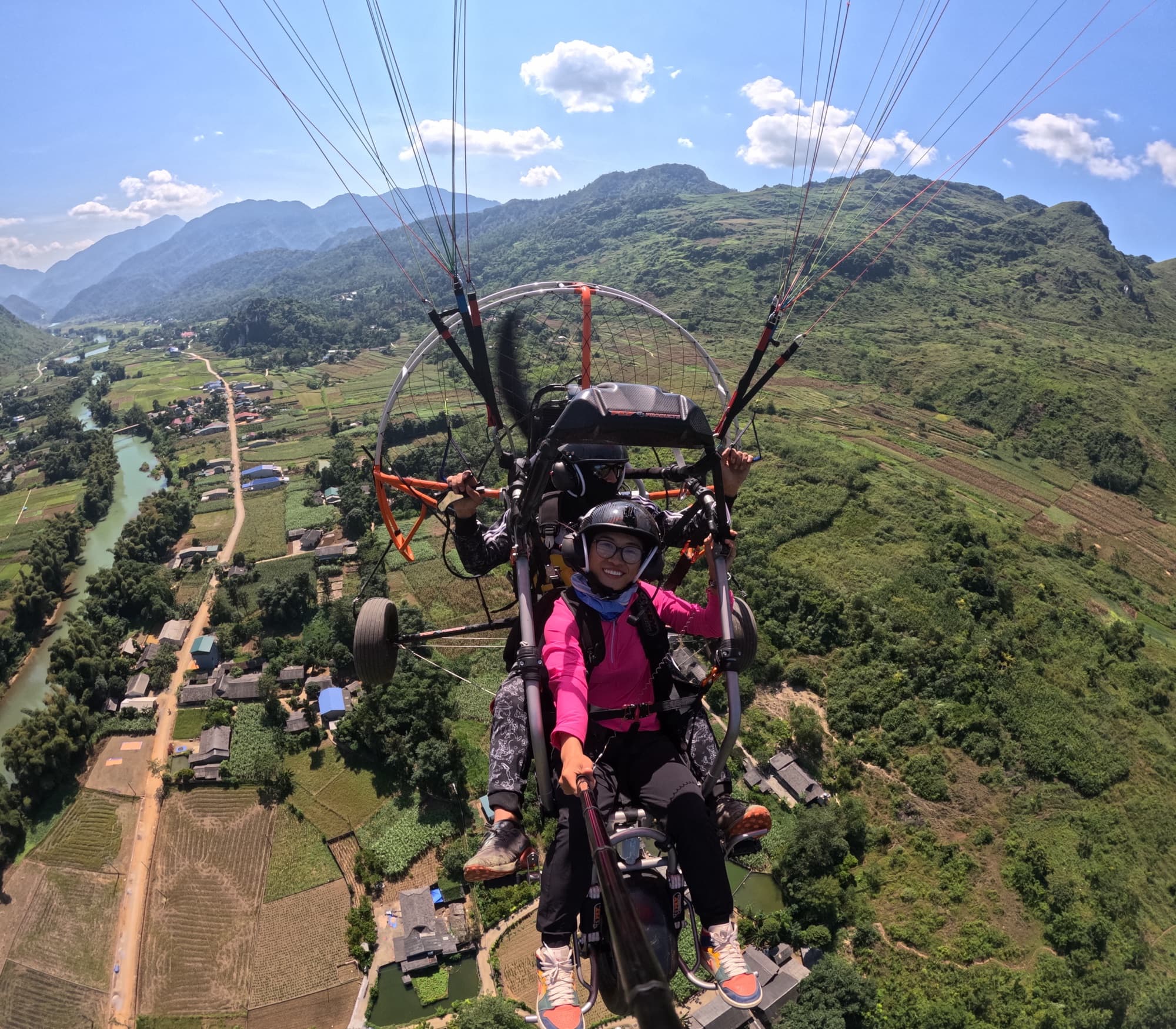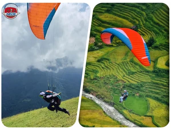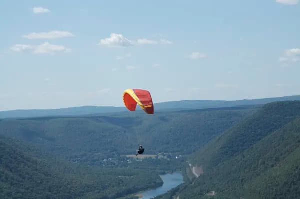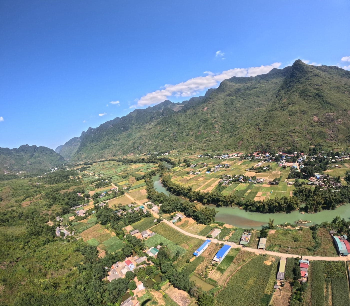
Quan Ba is Mebayluon's newest flying site: we operate here from 15 October 2026. The paragliding (PG) launch sits on a mountain slope at 950 m AMSL, the landing is a field in the valley at 450 m AMSL, and that same landing field is also the take-off for powered paragliding (PPG). So two kinds of flying share one patch of sky: paragliders gliding down from the mountain, and paramotors climbing up out of the valley.
This briefing is for solo pilots, PG or PPG, coming to Quan Ba for the first time: site numbers, the wind rule we already have, the daily mountain and valley wind cycle, PG technique, PPG technique in a limestone valley, seasons and the hazards to know about. The site is new, so some things do not have an official rule yet; where that is the case the article says inferred, so you know to check it yourself on site.
1. The Quan Ba site: numbers to remember
The landing lies almost due east of the launch, about 2.0 km in a straight line (computed from the two sites' coordinates, bearing about 87°). With 500 m of height difference you need a glide of only about 4:1 in still air to reach it. That is a comfortable margin for a modern wing but, as section 2 shows, the margin shrinks quickly when the wind blows against your glide.
| Item | Value | Source / note |
|---|---|---|
| PG launch | 23.0604025, 105.0189508 · 950 m AMSL | Coordinates from the site owner (25 Sep 2026) |
| PG landing = PPG take-off | 23.0612686, 105.0388558 · 450 m AMSL | Coordinates from the site owner; PPG launches in the valley and climbs |
| Distance, direction | ≈ 2.0 km, bearing ≈ 87° (almost due east) | Computed from the coordinates above |
| Height difference, glide needed in still air | 500 m · ≈ 4.1:1 | Computed |
| Published wind rule | West, northwest and southwest are TAILWIND: a forecast above 3 m/s means no flying; below 3 m/s you can still launch | Rule in Mebayluon's forecast |
| Mebayluon tandem flights (for a sense of flight time) | PG 10–15 min from the 950 m launch; PPG 15 min or 25 min (sunrise/sunset slot, while cloud still fills the small valleys around Tam Son) | Tandem products at Quan Ba |
| Legal | Flight permit 11323/TC-QC; paragliding business certificate 02/GCN-SVHTTDL (Tuyen Quang) | Ha Giang is now part of Tuyen Quang province |
2. Reading the wind: the 3 m/s tailwind rule, and what is still inferred
The only rule formally declared for the Quan Ba PG launch is the TAILWIND rule: west, northwest and southwest winds (each ±22.5°, so the whole sector from about 203° to 338°) blow from behind the launch. When the forecast wind at the launch is stronger than 3 m/s from this sector, there is no flying. Below 3 m/s you can still launch: a light tailwind is usually overridden by the midday upslope flow, and the launch keeps getting air from the valley side. The forecast calendars on Flying weather and Pilot registration mark days red by exactly this rule.
Which directions blow straight onto the launch has not been published by the site owner. Our inference: the tailwind sector is centred on west and the landing lies almost due east, so the launch most likely faces east, and easterly winds (northeast to southeast) blow onto the launch. North and south winds are probably crosswinds. This is an inference from the coordinates and the tailwind rule, not a rule. On site, trust the windsocks over this article.
Two general principles apply at every Mebayluon site, Quan Ba included. First, strong main wind (GIÓ XIẾT): a mean wind (not gusts) stronger than 6 m/s at launch level is beyond a wing's safety margin, and mountain terrain can push it higher still. Second, with a launch at 950 m, the forecast wind at launch altitude (roughly the 900–1,500 m layer) is closer to what you will meet on launch than the 10 m wind of a valley-floor station.
Headwind on the glide out
If the inference above is right, a day with an easterly onto the launch is also a day when you glide into wind for the whole 2 km to the landing. The table below is an illustrative calculation for a typical EN-B wing at trim speed of about 37 km/h (≈ 10 m/s), sinking about 1.1 m/s, in still air with no lift or sink. You need about 4.1:1 over the ground to reach the landing.
| Headwind on the glide | Glide over the ground | Reach the landing (needs ≈ 4.1:1)? |
|---|---|---|
| 0 m/s (calm) | ≈ 9:1 | Big margin |
| 2 m/s | ≈ 7:1 | Margin |
| 4 m/s | ≈ 5.5:1 | Yes, but one patch of sink eats the margin |
| 6 m/s (strong main wind) | ≈ 3.6:1 | No, unless you find lift |
The practical lesson: on a day when the easterly is picking up, launch with the glide home as plan A, keep spare height and pick backup fields along the line before you take off. Using the speed bar on an into-wind glide pays off in strong wind, but only when the air is smooth enough.
The daily wind cycle in a limestone valley
Quan Ba does not yet have a long enough flight log to pin down exact times, so this part applies the mountain meteorology in the books (Pagen, Understanding the Sky; Bay Thermal) to Quan Ba's terrain. Treat it as a framework for observation, not a fixed timetable.
- Early morning: cold night air pools on the valley floor and forms an inversion; the valley can sit under cloud or fog while the slopes are in sun. Downslope and down-valley drainage is still running, so a launch facing the valley can have a light tailwind before the upslope flow starts.
- Mid-morning: the upslope (anabatic) breeze starts on the upper slopes and spreads down, earliest on slopes that get early sun. If the launch faces east (inferred), it gets sun early: thermals start early but are often weaker than expected.
- Midday and early afternoon: the up-valley wind builds, usually peaking mid-afternoon. Large limestone faces heat slowly but become strong from early afternoon, so thermals off the rock can turn sharp in this window.
- Late afternoon: an east-facing slope is the first to lose the sun. When it goes into shade, downslope flow can arrive suddenly, strongly and in surges, turning into a tailwind on launch (inferred from the launch orientation). Limestone releases its heat in the evening and can give smooth lift on faces still in sun.
- Landing in the valley late in the day: expect sudden changes in wind direction and speed, and wind shear, as the valley wind reverses.
3. Paragliding (PG) at Quan Ba
Launch
- Before laying out, read the launch windsock and ask about the wind at the landing (radio or someone below). At Khau Pha we have seen the launch sock alone fool pilots almost every time; at a new site, do not trust a single sock.
- If there is a tailwind component from the west sector, do not lay out and hope. Wait for the upslope cycles to come in steadily, or do not fly.
- Watch for at least 15–20 minutes before your first flight at an unfamiliar launch. A change of more than 2 m/s within a few seconds means turbulence, not a nice cycle.
- A smooth upslope breeze at the edge of launch can hide turbulence behind the ridge when the wind aloft is westerly. Check the forecast wind at ridge-top height, not just at launch.
Finding lift
- Ridge lift is best about 20–80 m out in front of the windward slope, not right against it. Fly figure-eights and always turn away from the slope.
- Good thermal sources are bare rock, open ground and dry fields in the sun; dense forest releases late and weak. Bare limestone faces become strong triggers from early afternoon.
- Do not look for lift on the lee side of a limestone block. At Quan Ba every peak and rock face in the valley has a lee zone downwind, many times as long as the block is high.
- As the wind picks up (from about 5 m/s): fly higher and keep away from sheltering spurs and gaps, where the wind accelerates through the narrowing (venturi effect).
Glide out and landing
- Commit to the landing early; do not wait until you are down at the level of the rock towers. Pick backup fields along the line before you launch.
- The landing is also the PPG take-off. Before joining the circuit, look and call on the radio to check whether a paramotor is on its take-off run or has just left the ground. Do not fly right behind a PPG: its wake persists for about 2 minutes.
- The wind at the landing can differ from the wind on launch, especially in the afternoon when the valley wind is strong. Read the landing windsock from height, join the circuit early and make the final approach decisive.
- Late in the day: watch for wind gradient in the last few tens of metres and for sudden reversals.
4. Flying a paramotor in a limestone valley
Core PPG technique (pre-flight, starting, throttle, riser twist, power-off landings, emergencies) is in Paramotor (PPG) Fundamentals. This section covers only what is specific to Quan Ba: launching from the floor of a narrow valley ringed by limestone walls and towers, over small fields, villages and forest. Figures are from Powered Paragliding Bible (Jeff Goin), converted to metres and m/s.
Climbing out of the valley
- Climb straight into wind. Turn limits while low: no more than 30° below 9 m, 90° below 18 m, 180° below 30 m. Climb into wind to about 60 m before turning downwind.
- Climb to at least 90 m AGL while staying within glide of the field. Throughout the flight, keep about 150 m above the terrain below you so you can glide back if the engine quits.
- Narrow valley: before take-off, work out an escape route in case the climb is weaker than expected. Never climb straight at a rock face hoping to clear the top.
- Wind funnelling through a gap between two massifs can hold a paramotor almost stationary. Add power and climb out rather than trying to push through the gap low.
Rotor behind the rock towers, and terrain clearance
- Turbulence behind an obstacle extends about 4–10 times the obstacle's height at 4.5 m/s, sometimes up to 20 times. At 6.7 m/s it is twice as strong as at 4.5 m/s. Below about 2.2 m/s, obstacle turbulence is negligible.
- Behind a rock tower standing 200 m above the fields, the lee zone can be a kilometre long. Go round on the upwind side of the tower, or cross it with a large height margin.
- Rotor behind a mountain can reach from below the summit almost down to the ground. A calm PPG field on the valley floor does not mean there is no wind aloft: the valley may simply be in a wind shadow.
- When the wind blows across a narrow valley, a single rotor can fill most of it. On a westerly day (tailwind for the PG launch), be especially careful on the east side of the ridges.
Engine out: choose your field before you need it
With the engine off the wing still glides about 6:1. On a plain that is generous, but at Quan Ba the ground is small fields mixed with forest, villages and slopes. Priorities for an outlanding: always flare; pick good ground; land into wind; stay out of rotor; never land uphill (land across the slope if you must); look for power lines; watch for livestock; think about where the wing will fall; think about whether the retrieve can reach you. Terraced fields make poor emergency landing areas.
Sunrise and sunset cloud flights
- The cloud filling the small valleys around Tam Son at dawn is inversion fog: cold air pooled in the hollows, most stable about 30 minutes after sunrise, then breaking up.
- Flying over an unbroken cloud sea beyond gliding range of a clear area means that an engine failure forces you down through the cloud, where fog also hides the power lines. Gliding range to cloud-free ground is a hard limit on a cloud flight.
- Cold air draining off the mountains can become a strong flow even before dawn, stronger still in passes and narrowings. Check the real wind before a sunrise flight.
- Sunset flights: thermals can stay strong until a couple of hours before sunset. Land while there is still enough light to see power lines.
Engine, field and neighbours
- The PPG field is at 450 m, below the roughly 900 m threshold above which the book recommends leaning the carburettor. An engine leaned for a high site (Khau Pha, for example) must be re-enriched here, or it will overheat. Check maximum RPM on the field every day.
- On hot, humid summer middays the engine makes less power and the wing less lift: the take-off run can be three times as long as on a cool morning.
- Powered gives way to unpowered. Do not motor around near the PG launch and do not circle in airspace the paragliders are using.
- Noise is the quickest way to lose a site. Take off and leave, throttle back near houses, and do not buzz villages or livestock. Spectators stay at least 6 m outside the plane of the propeller.
5. Seasons at Quan Ba
| Period | Character | What to watch |
|---|---|---|
| October – December | Dry, long visibility, buckwheat flower season | Morning inversions and cloud seas in the small valleys; the valley can stay "closed" until nearly midday with weak thermals |
| Cold surges (winter) | Sudden, strong, gusty wind shifts as the front passes | No flying while the front goes through; once the wind eases there are often clear days with crisp thermals |
| Late winter – early spring | Low stratus, drizzle and haze can last for days | A high launch can sit above the cloud sea or right inside the cloud: poor visibility means no flying |
| February – April | Peach and plum blossom | Warm moist air over cold mountains: stable, layered cloud, poor thermals |
| May – September (rainy season) | Hot and humid, convective cloud almost every day | Fly morning to early afternoon; watch cumulus towering up and land before the storm |
Thunderstorms. A storm forecast does not automatically make a day unflyable; storm days often have strong thermals. But a big storm has to be weighed for that time window, and you always land before the cell arrives: if you hear thunder you are already in range, land now. Watch for dark cloud and rain curtains upwind: the gust front arrives before the rain and can run tens of kilometres ahead of the storm. After a storm, wait 1–2 hours before thinking about flying again.
6. Hazards to know about
- Rotor and lee zones behind every rock tower, cliff and ridge, especially on westerly days (tailwind on the PG launch).
- Venturi through gaps and where the valley narrows; strong main wind when the wind around launch level exceeds 6 m/s.
- Late-afternoon downslope flow on east-facing slopes (inferred): it can turn the launch into a tailwind within minutes.
- Power lines across the valley are almost invisible from above. The location of each line at Quan Ba has not been published: ask on site before your first flight. If you must cross, cross at the pylons with height to spare; survey new routes at 60 m or more.
- Villages: do not fly low over houses; paramotor noise disturbs people and panics animals.
- Livestock in the fields: buffalo, cattle and goats may be standing on the very field you pick for an emergency landing, and they panic when a wing or engine comes close.
- Terraces and slopes: poor emergency landing areas; never land uphill.
- Cloud and fog: early-morning cloud seas and winter stratus can cover the whole site; paragliding is visual flying, poor visibility means no flying.
- Two kinds of flying on one field: the PG landing is the PPG take-off. Use the radio, give way to paragliders, stay out of paramotor wake.
7. Before you go
- Register and pay the site fee on Pilot registration: choose Quan Ba, and buy by the day, month or year. The page also shows a 15-day forecast calendar for the site.
- Check the hourly forecast on Flying weather: Quan Ba has its own table, coloured by the tailwind rule above.
- Save the radio frequencies shown on the registration page and the hotline 0964 073 555. The radio is how you talk to the landing, which is also the PPG field.
- Minimum equipment: helmet, radio, reserve. This is also the requirement in the rules of our Vien Nam site. Quan Ba's own site rules (flying area, experience requirements) have not been published yet: ask via the hotline when you register.
- Tell someone on the ground your flight plan, and carry a charged phone and a tracker if you have one.
Summary
- PG launch 950 m, landing 450 m about 2 km to the east; the landing is also the PPG take-off.
- West, northwest and southwest are tailwind: a forecast above 3 m/s means no flying. Easterlies blowing onto the launch are an inference, not yet a rule.
- A strong easterly means gliding home into wind: at 6 m/s your glide over the ground is no longer enough without lift.
- Every limestone block has a lee zone many times its height: go round on the upwind side.
- PPG: climb into wind, stay within glide of the field, choose your field before you need it, and do not cross a cloud sea beyond gliding range.
- Land before the storm, before dark, and always look hard for power lines, livestock and people.
Safety comes first. Keeping yourself safe is how you keep others safe.
— Mebayluon Paragliding
This article is for pilots. If you are a visitor looking for a tandem flight at Quan Ba, read Paragliding on the Ha Giang Loop or see the Quan Ba site page. For comparison with another mountain site, see Flying Khau Pha — the three main wind scenarios.
See the flying weather forecast
Sources: site coordinates, altitudes and the wind rule come from Mebayluon's site owner (25 Sep 2026) and are used in our forecast system; Pagen, Understanding the Sky, and the book Bay Thermal for mountain meteorology; Jeff Goin, Powered Paragliding Bible, 7th edition (2022), for the PPG part. Table 2 is an illustrative calculation. Points marked inferred are not site rules yet; this article will be updated when the site owner publishes the full wind rules.